
This is a sample of the briefing we sent to our clients the morning of Wednesday, August 20th, 2025, on impacts expected from Hurricane Erin along the East Coast of the United States.
Wind Impacts Start Later Today Along The Mid-Atlantic Coast From Erin
Praedictix Briefing: Wednesday, August 20th, 2025
Key Messages:
- Wind concerns will begin later today along the North Carolina coast as the outer bands of Erin move in. Coastal concerns – including storm surge, high waves, and rip currents – continue along the East Coast for the next several days.
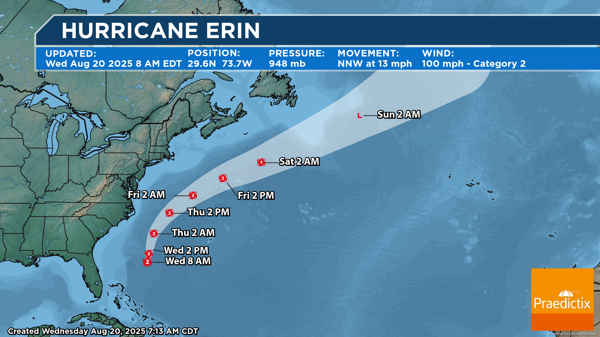
Erin Track. Erin will continue to remain offshore the East Coast of the United States this week. However, the wind field is expanding with this system, meaning that we are likely to see tropical storm force wind gusts along portions of the Mid-Atlantic Coast starting later today and lasting into Thursday. We will also continue to see coastal impacts, including rip currents, high waves, and storm surge. As of 8 AM EDT, the center of Erin was sitting about 400 miles south-southeast of Cape Hatteras, NC, and the storm was moving north-northwest at 13 mph. The wind field was large, with hurricane-force winds extending out 90 miles from the center and tropical storm force winds extending 265 miles from the center.
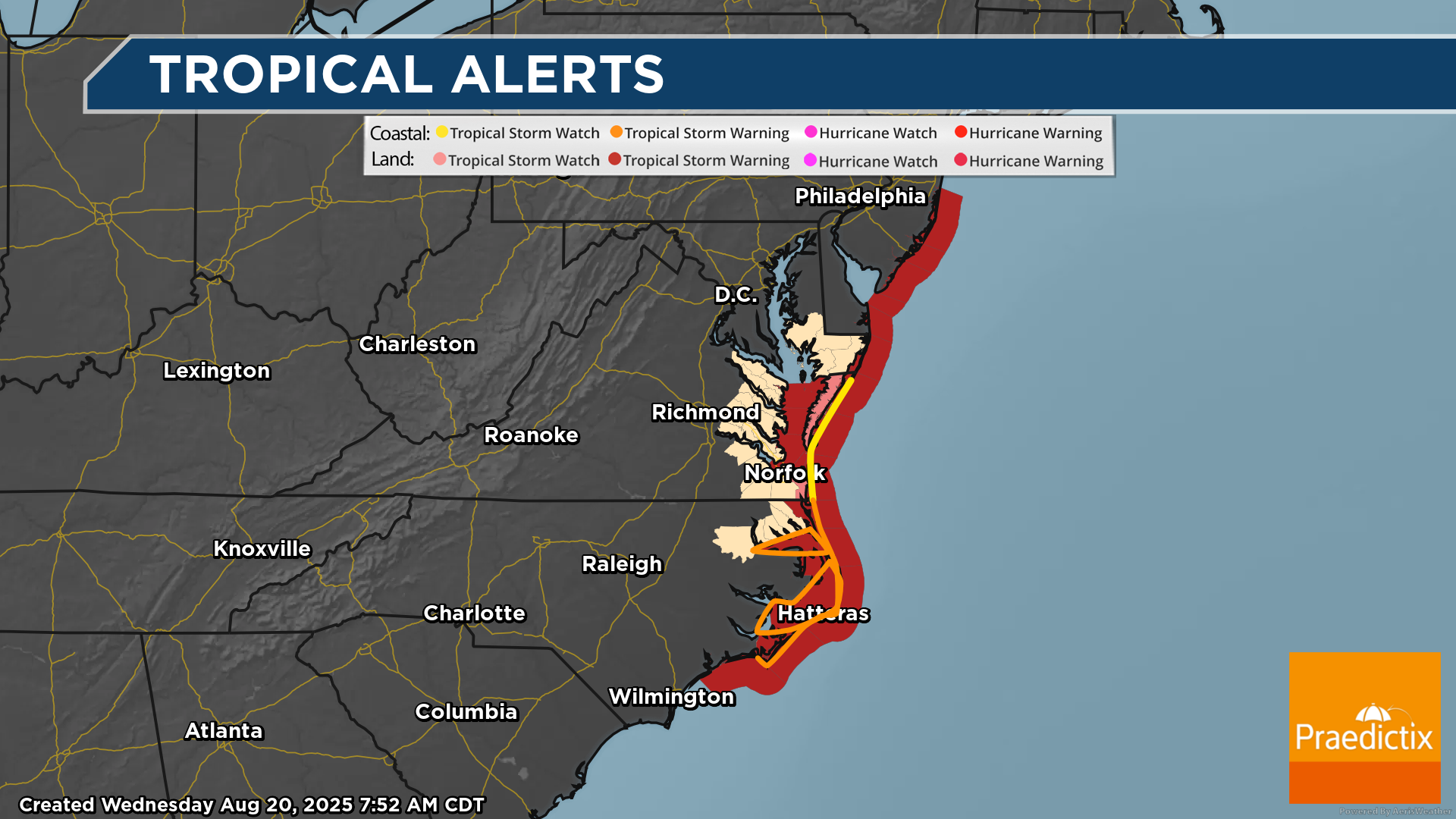
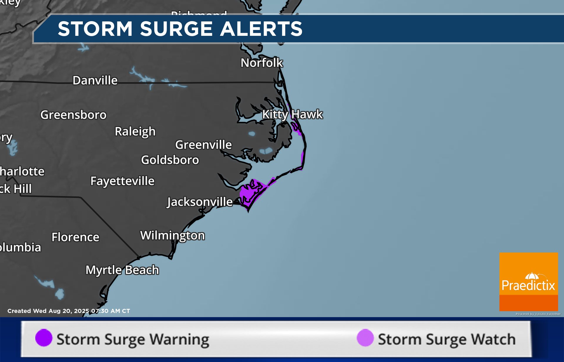
Tropical Alerts Along The East Coast. With that large wind field associated with Erin, tropical storm force winds will be felt as far away from the center as parts of the Mid-Atlantic Coast, where Tropical Storm Warnings (Beaufort Inlet, North Carolina to the North Carolina/Virginia border, including Pamlico and Albemarle sounds) and Watches (North of the North Carolina/Virginia border to Chincoteague, Virginia) are in place. Tropical Storm Watches are also in place for Bermuda. This system will also continue to cause coastal concerns, including rip currents, high surf, and the potential of storm surge. Storm Surge Warnings are in place from Cape Lookout to Duck.
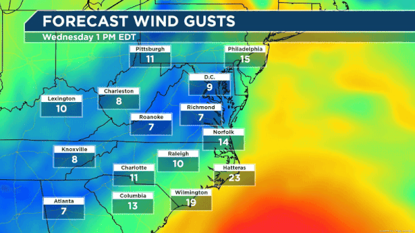
Wind Gust Forecast. As Erin approaches – but stays offshore – you can see the wind gradually increase later today into tonight in the Outer Banks. Tropical storm force winds (39+ mph) are possible from Wednesday evening through Thursday afternoon. peaking during the morning hours of Thursday in the 40-55 mph range. The strongest winds are expected along the immediate coast and adjacent sounds.
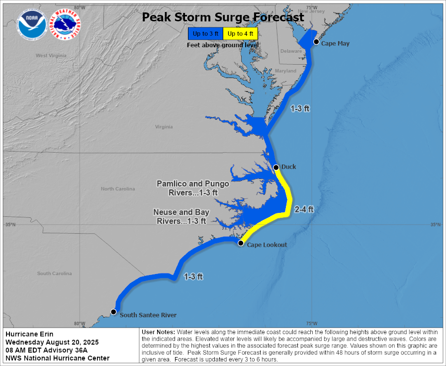
2-4 Foot Storm Surge. Due to the combination of storm surge and high tide, areas along the coast from South Carolina to at least Cape May could see a push of water moving inland at times – especially at high tide. The greatest impacts will be from Cape Lookout to Duck, where 2-4 foot storm surges could occur. This would leave normally dry areas underwater due to the rising waters.
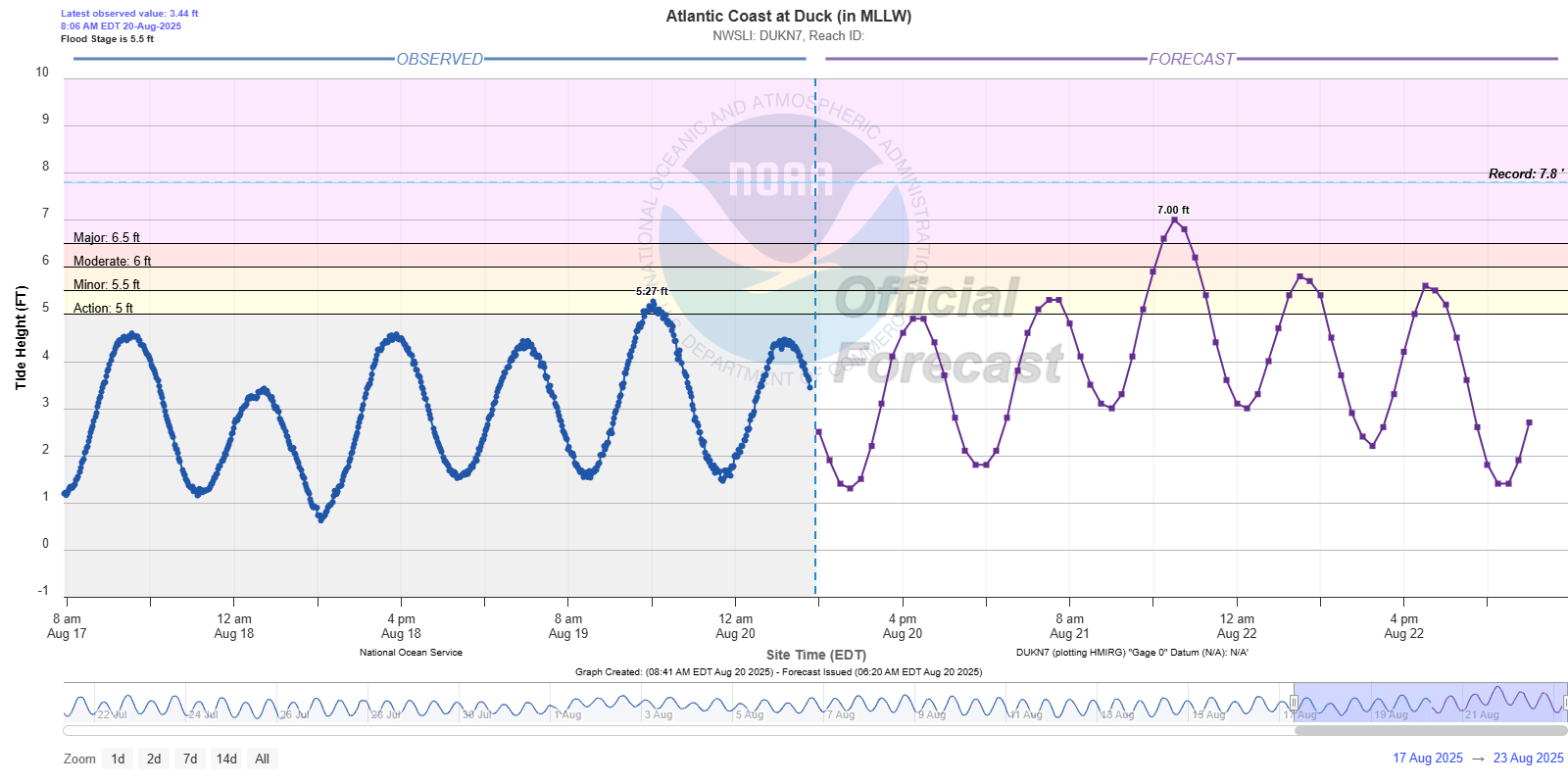
Forecast Coastal Water Levels At Duck, NC. At high tide Thursday evening in Duck, NC, the water level is expected to reach 7 feet (major flood stage). That would be a top-five highest crest on record along the coast at Duck. After that, the two tide cycles on Friday are expected to reach at least minor flood stage.
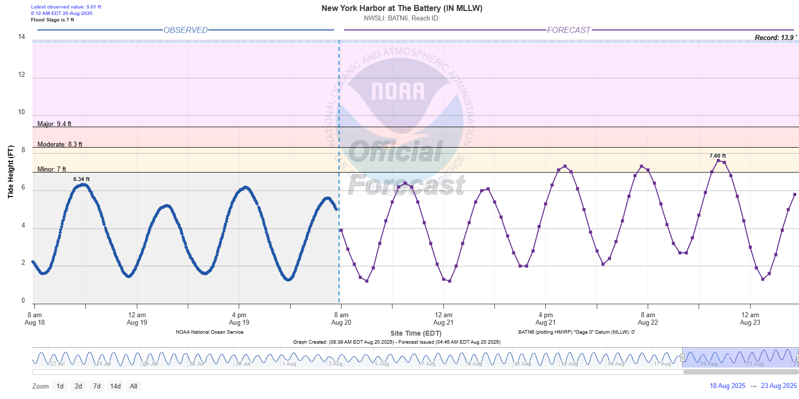
Forecast Coastal Water Levels At New York Harbor. In New York Harbor, water levels are expected to reach minor flood stage for at least three high tide cycles between Thursday evening and Friday evening.
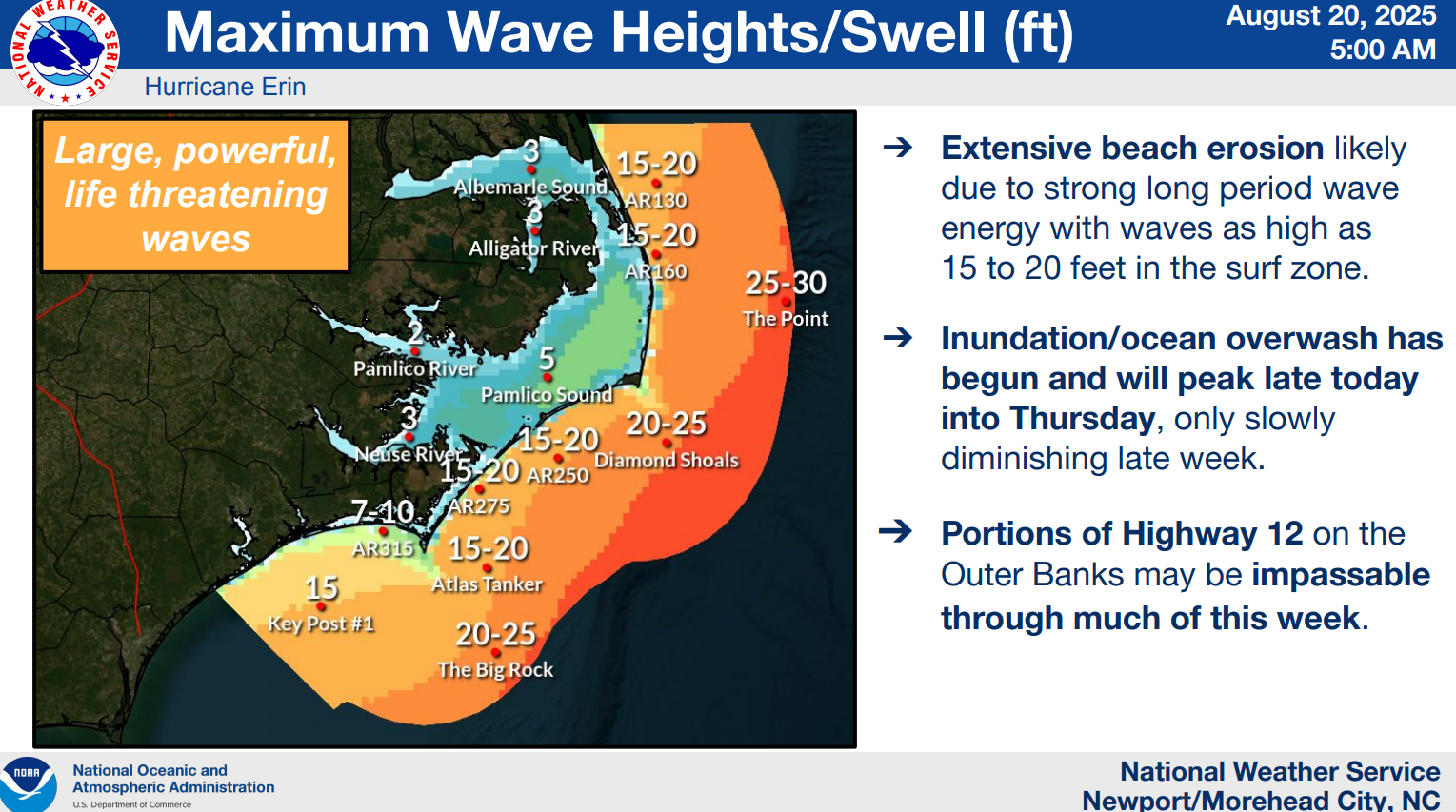
Wave Heights Along The Outer Banks. We could see 10-20 foot waves near the Outer Banks in association with Erin moving past to the east, causing coastal flooding and ocean overwash concerns. NWS Newport is warning that Highway 12 may end up being impassible for days after this event due to the overwash.
Follow Praedictix Weather On Social Media:
Follow Meteorologist D.J. Kayser on Social Media: