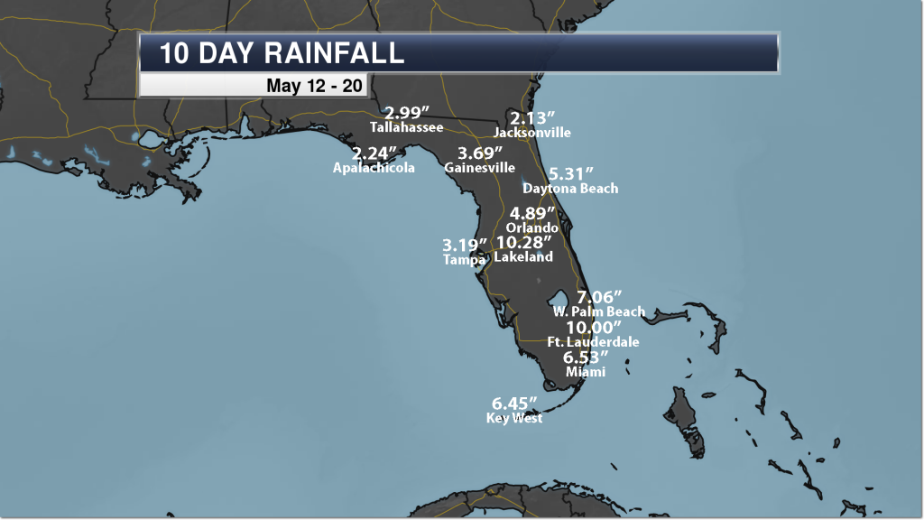
The Sunshine State of Florida has not exactly been living up to its name over the past 10 days, as a plume of deep tropical moisture has impacted the region. This has led to heavy rain across the state and reports of flooding in southern Florida according to NBC Miami. Some roads were even closed by the Fort Lauderdale airport.

Some of this rain fell within a relatively short amount of time. For example, Sunday was the fourth wettest May day in Fort Lauderdale history with 5.27″ falling at the airport. The rain Sunday knocked the previous record for the day (4.86″ in 2013) down to the sixth all-time wettest May day.
Additional Heavy Rain This Week

We continue to watch the potential of more rain across Florida and the Southeast through at least the middle of the week. Our automated weather graphics show the potential of an additional 0.50″-2.00″ of rain through Wednesday across parts of the Sunshine State. Find out how to get automated weather graphics for your website, television station, or business:

The Praedictix meteorologist team is also keeping an eye on a potential disturbance for the second half of the week. As of Monday morning, the National Hurricane Center has only about a 20% probability of this disturbance developing into a tropical system. Even if this system does not form into something tropical, this will bring the potential of additional heavy rain to parts of the Gulf Coast – including Florida – into the Memorial Day weekend.
– Meteorologist D.J. Kayser
Follow Meteorologist D.J. Kayser on social media:
Follow Praedictix Weather on social media:

