

Growing Drought Here While “Delta” Threatens
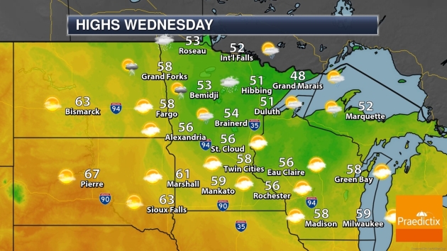
It’s 2020 so I’ll ask a question with no apparent answer. “Can the weather ever be too nice?” September was glorious and this week has been a balm for the senses. Low 80s today?
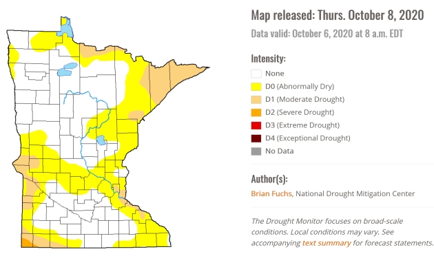
But a weather winning-streak of sunny days and few storms has left us increasingly dry. In fact, moderate drought conditions are showing up in the east metro, the Arrowhead and far western counties, with a sliver of severe drought reported near Worthington. We’ll pick up a few hours of showers Sunday night, but not nearly enough rain to recharge streams and soil moisture.
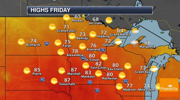
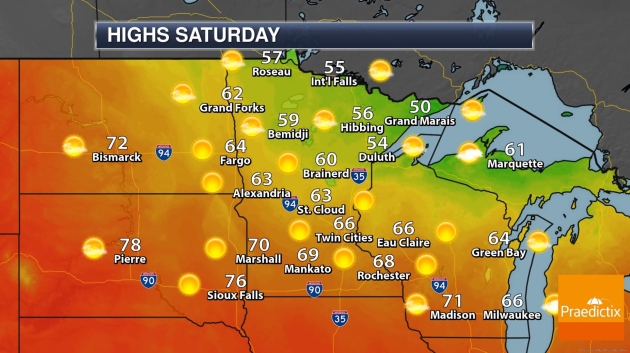
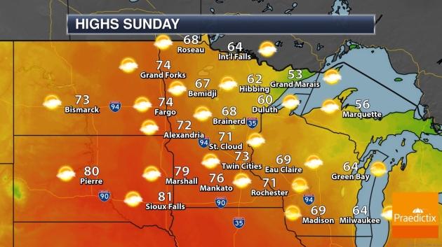
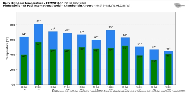
A balmy Friday gives way to a cooler Saturday, before temperatures mellow a bit on Sunday, when showers should hold off until after dark.
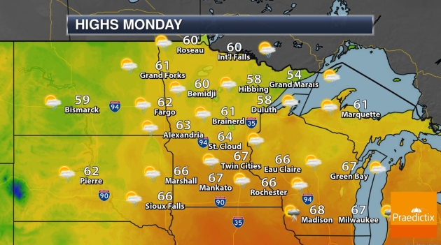
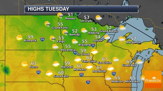
A few minor slaps of cooler air sweep across Minnesota next week, with a rerun of jackets.
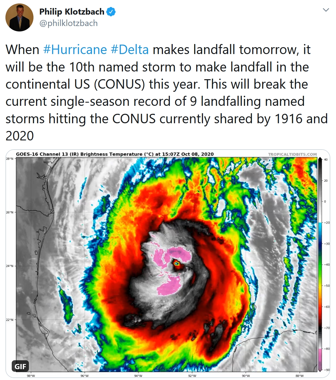
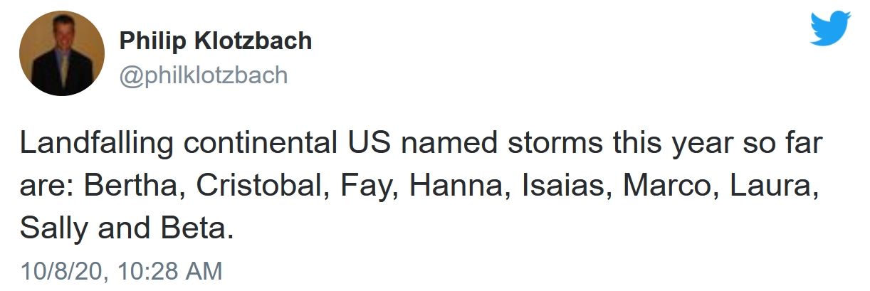
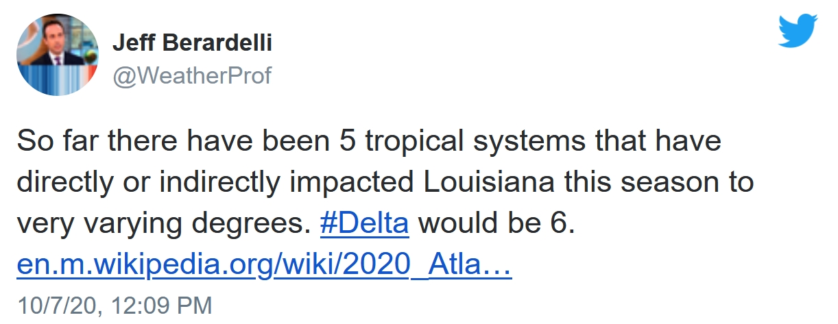
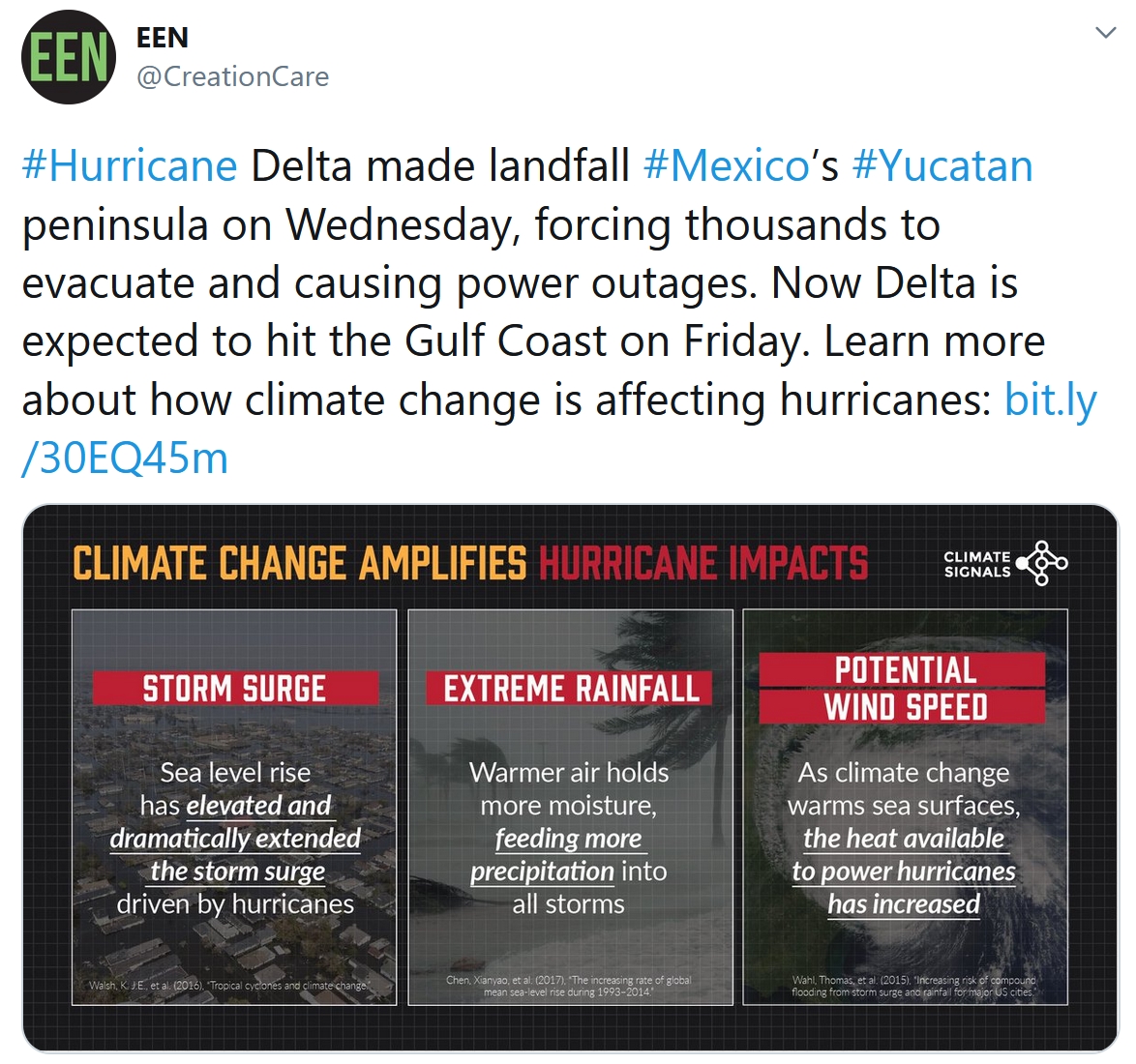
Meanwhile, dangerous Hurricane Delta will hit coastal Louisiana later today as a Category 3; the same area battered by “Laura” in late August. “Delta” is the 5th hurricane to hit the U.S. in 2020, the most landfalls since 2005.
Photo credit: Pete Schenck.

Praedictix Intermediate Briefing: Issued late Thursday afternoon, October 8, 2020:
Key Points:
– Hurricane “Delta” is the 6th tropical system to impact Louisiana in 2020, hitting roughly the same area impacted severely by Hurricane Laura in late August.
– Hurricane Delta has strengthened back into a Category 3 storm, growing larger over time with a broad windfield and significant storm surge.
– Although not as severe as Hurricane Laura, Hurricane Delta will cause very considerable coastal storm surge flooding as well as flash flooding hundreds of miles inland after landfall in the next 72 hours.
– Hurricane Delta is the 5th hurricane to hit the U.S. coastline in 2020, the most since 2005, when “Katrina” flooded New Orleans.
– Although metro Houston and New Orleans will be spared a direct strike, flash flooding and (minor) storm surge damage can’t be ruled out. We are most concerned about Lake Charles, Lafayette and Baton Rouge, with severe inland flooding within 200-300 miles of the Gulf Coast.
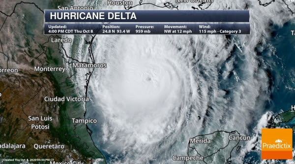
Delta is Strengthening Again. Hurricane Delta weakened considerably after hitting the Cancun area on Mexico’s Yucatan Peninsula. Slightly cooler water closer to the coast may prevent rapid intensification, but there is every indication “Delta” will hit as a strong Category 3 hurricane late Friday and Friday night. Latest update from NOAA NHC:
…DELTA REGAINS MAJOR HURRICANE STRENGTH OVER THE WESTERN GULF OF
MEXICO…
…HURRICANE CONDITIONS AND LIFE-THREATENING STORM SURGE EXPECTED
TO BEGIN ALONG PORTIONS OF THE NORTHERN GULF COAST ON FRIDAY…
SUMMARY OF 400 PM CDT…2100 UTC…INFORMATION
———————————————-
LOCATION…24.8N 93.4W
ABOUT 345 MI…555 KM S OF CAMERON LOUISIANA
MAXIMUM SUSTAINED WINDS…115 MPH…185 KM/H
PRESENT MOVEMENT…NW OR 320 DEGREES AT 12 MPH…19 KM/H
MINIMUM CENTRAL PRESSURE…959 MB…28.32 INCHES
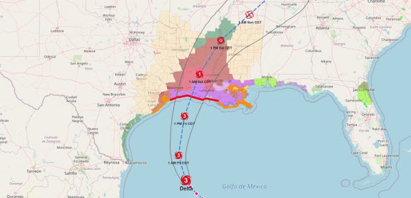
Projected Track of Delta. Models are in fairly good agreement that Delta will thread the needle, passing between Houston/Galveston and New Orleans, but areas that usually flood during tropical systems in the Houston and New Orleans metro areas may experience flooding from Delta, with the best chance of overflows and urban flooding Friday afternoon into midday Saturday.
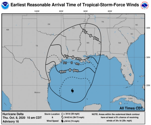
Arrival of Tropical Storm-Force Winds. Tropical storm force winds are defined as sustained winds of 39 mph or higher, and those conditions will reach the Gulf Coast by early Friday morning. Coastal evacuations in Louisiana and hardening of facilities and contingency plans in Houston and New Orleans should be rushed to completion this evening.

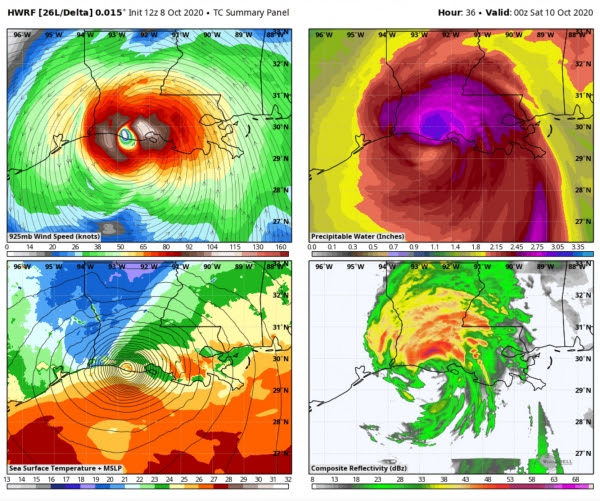
Similar Model Solutions. NOAA’s hurricane models, HMON (top) and HWRF (bottom) both show nearly identical solutions for landfall along the southwestern coastline of Louisiana. When models agree, our confidence levels go up. Houston and New Orleans aren’t entirely out of the woods, but with each passing our it seems more likely that Hurricane Delta will spare these large metropolitan areas a direct strike late Friday.
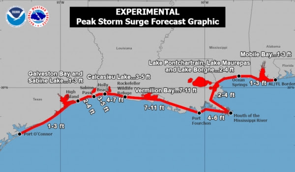
Peak Storm Surge Potential. Remember, the worst storm surge (a sudden rise in water levels ahead of the “eye”) occurs east, or to the right of where the eye comes ashore. Vermillion Bay, Louisiana may experience a storm surge of 7-11 feet above average sea levels, with wind-whipped waves superimposed on the surge. A 2-4 foot surge is possible on Lake Pontchartrain, north of New Orleans.
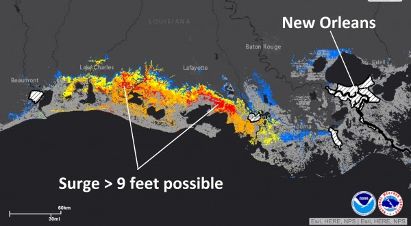
Most Severe Coastal Flooding Potential. We’ve zoomed into the area of greatest concern, southeast of Lake Charles, where storm surge flooding will be severe, nearly as bad as the surge flooding created by Hurricane Laura in late August.
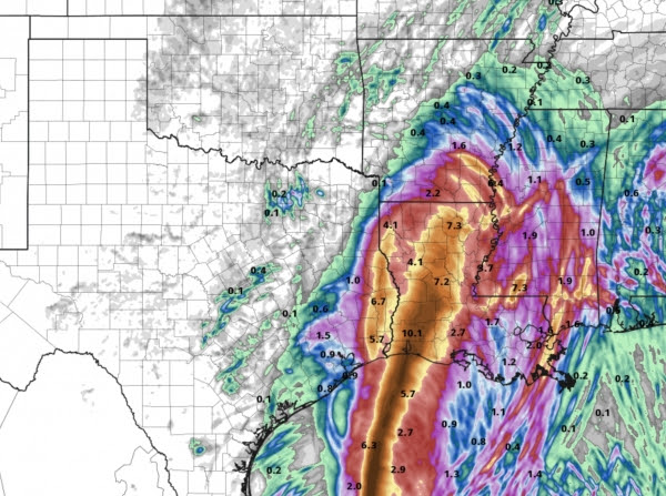
Rainfall Potential from “Delta”. Models print out 5-10″ rains over much of western and central Louisiana into southeast Arkansas, where flash flooding is likely. A friendly reminder not to focus entirely on coastal communities – flash flooding is likely hundreds of miles inland.
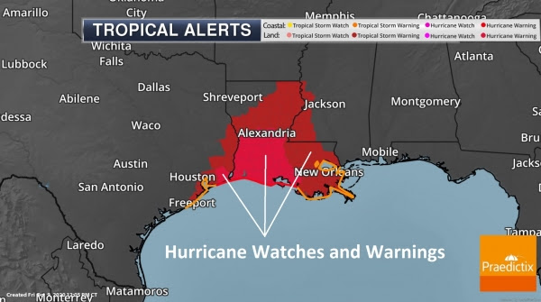
Current Watches and Warnings. Hurricane Warnings and Watches are posted for most of Louisiana, where tornadoes are likely as the core of Delta’s spiral bands come ashore. An isolated tornado can’t be ruled out as far west as Houston, and as far east as New Orleans, Gulfport and Mobile.
Summary: Hurricane Delta is a dangerous, Category 3 hurricane, capable of a very damaging storm surge pushing several miles inland along coastal Louisiana. Houston will experience heavy rain and flash flooding with a 2-4 storm surge. Minor to moderate flooding is possible in the New Orleans metro area. But confidence levels are high that “Delta” will pass between these metro areas, delivering a punishing blow to smaller cities like Lake Charles, Lafayette and Baton Rouge, still cleaning up from Hurricane Laura back in April. Another briefing Friday morning.
Paul Douglas, Senior Meteorologist, Praedictix
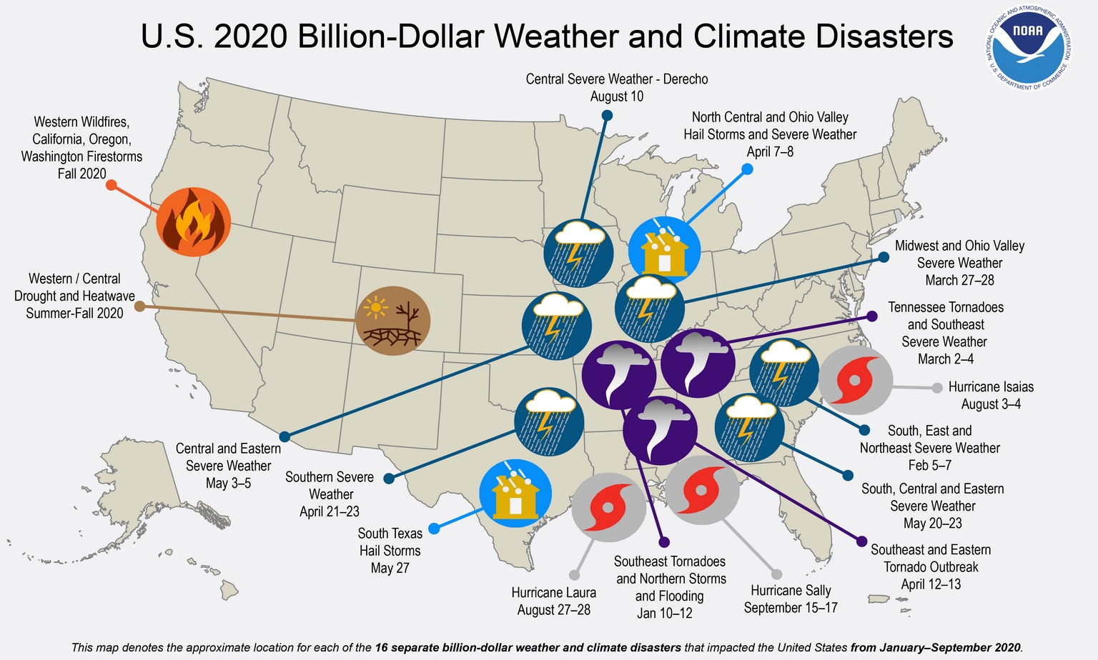
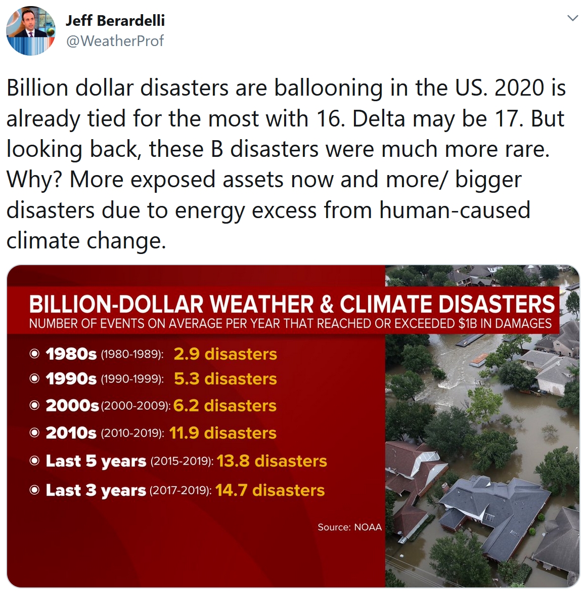
U.S. Hit by 16 Billion-Dollar Disasters This Year, So Far. NOAA has an update on another crazy year of weather extremes: “…From January through the end of September of this year, the U.S. has experienced 16 weather and climate disasters with losses exceeding $1 billion each. Eleven were due to severe storms—which occurred across more than 30 states—and the remaining 5 comprised one wildfire, one drought and three tropical cyclones. With 16 disasters so far, 2020 has already tied with 2011 and 2017 for the largest number of disasters in a calendar year. This is also a record sixth-consecutive year where 10 or more billion-dollar disasters have struck the U.S...”
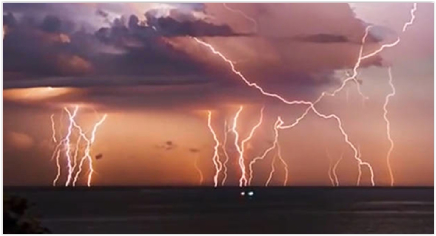
The U.S. Could See the Fewest Recorded Deaths from Lightning Strikes This Year. One silver lining in during a volatile year of weather extremes. CNN.com reports: “In a year of increasingly bleak headlines, here’s one uplifting piece of news: The US is on track to experience the fewest recorded deaths from lightning strikes in a single year. Fourteen people have died from lightning strikes in the US so far this year. And because peak lightning season in the Northern Hemisphere takes place during June, July and August, the worst is likely behind us. Even if a few more deaths are reported in the next three months, the overall toll will still be below what we usually see, says John Jensenius, a meteorologist and lightning safety specialist with the National Lightning Safety Council…”
File image: NASA.
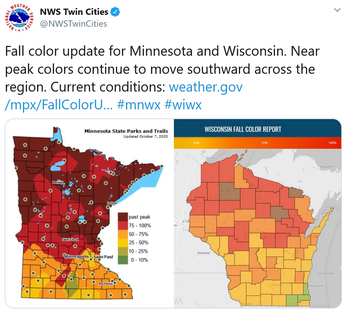
Peaking Fall Color. Much of central and northern Minnesota is already past-peak, but this may be the weekend in and around the MSP metro area to take in an eyeful of color. Southeastern Minnesota? Peek color probably comes within 5-8 days.

Now There’s a Dr. Fauci Action Figure. CNN.com has a story that’s perfect for 2020: “…House Speaker Nancy Pelosi and Dr. Anthony Fauci, director of the National Institute of Allergy and Infectious Diseases, are getting the action figure treatment. FCTRY, a Brooklyn-based product design company, said it raised over $200,000 on a Kickstarter page — surpassing its initial $15,000 goal — to help them produce the toys. Dr. Fauci’s figurine is dressed in a white coat and removable mask. The action figure sports the doctor’s signature glasses, and has his stethoscope ready to go in his front pocket…”

Is Listening to “Baby Shark” a Form of Torture? ABC News has another vaguely surreal story: “Two former Oklahoma jail employees and their supervisor face misdemeanor cruelty charges after investigators found they forced inmates to stand handcuffed for hours and listen to the children’s song “Baby Shark” on repeat, a prosecutor said Monday. At least four inmates were secured to a wall with their hands cuffed behind them while the song played on a loop at a loud volume for hours…”
Image credit: YouTube.
68 F. high in the Twin Cities on Thursday.
62 F. average high on October 8.
72 F. high on October 8, 2019.
October 9, 1970: Montevideo sets a record low high temperature of 35.
October 9, 1938: Forest fires on the 9th and 10th claim 21 lives in northern Minnesota.
FRIDAY: Sunny, windy and warm. Winds: SW 15-25. High: 83
SATURDAY: Blue sky, a cooler day. Winds: NE 5-10. Wake-up: 50. High: 67
SUNDAY: Fading sun, nighttime T-storms. Winds: SE 15-25. Wake-up: 56. High: near 70
MONDAY: Damp start, then clearing skies. Winds: NW 15-25. Wake-up: 53. High: 66
TUESDAY: Peeks of sun, still breezy. Winds: W 10-20. Wake-up: 48. High: 61
WEDNESDAY: Partly sunny, not bad. Winds: NW 10-20. Wake-up: 51. High: 71
THURSDAY: Gusty, chilly sting in the air. Winds: NW 15-25. Wake-up: 49. High: 58
Climate Stories…
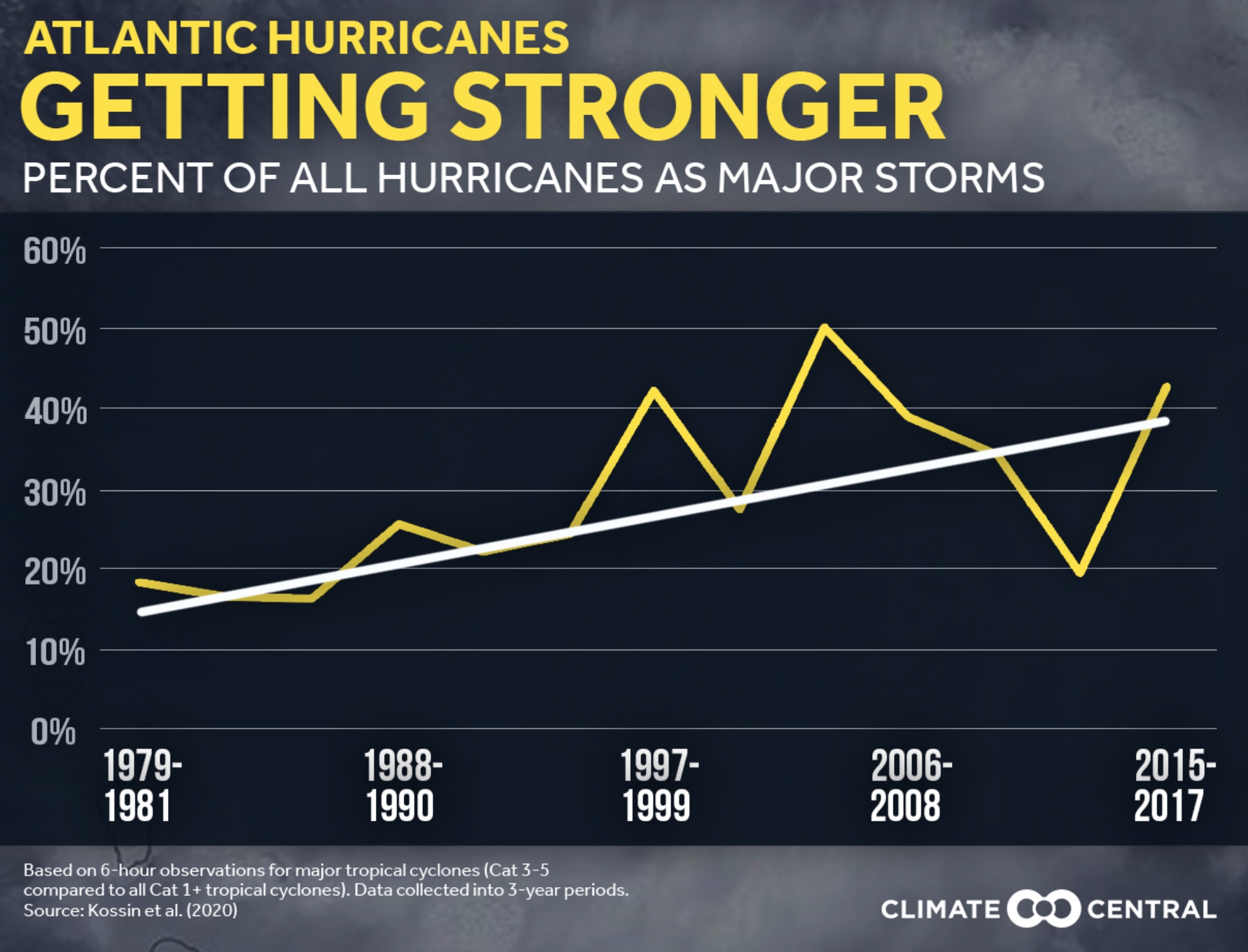
Climate Change is Making Hurricanes Stronger, Researchers Find. The number of hurricanes isn’t increasing, but the storm that do develop stand a better chance of becoming Category 3 strength or stronger, according to new studies highlighted at The New York Times (paywall): “Hurricanes have become stronger worldwide during the past four decades, an analysis of observational data shows, supporting what theory and computer models have long suggested: climate change is making these storms more intense and destructive. The analysis, of satellite images dating to 1979, shows that warming has increased the likelihood of a hurricane developing into a major one of Category 3 or higher, with sustained winds greater than 110 miles an hour, by about 8 percent a decade. “The trend is there and it is real,” said James P. Kossin, a researcher with the National Oceanic and Atmospheric Administration and lead author of the study, published Monday in Proceedings of the National Academy of Sciences...”
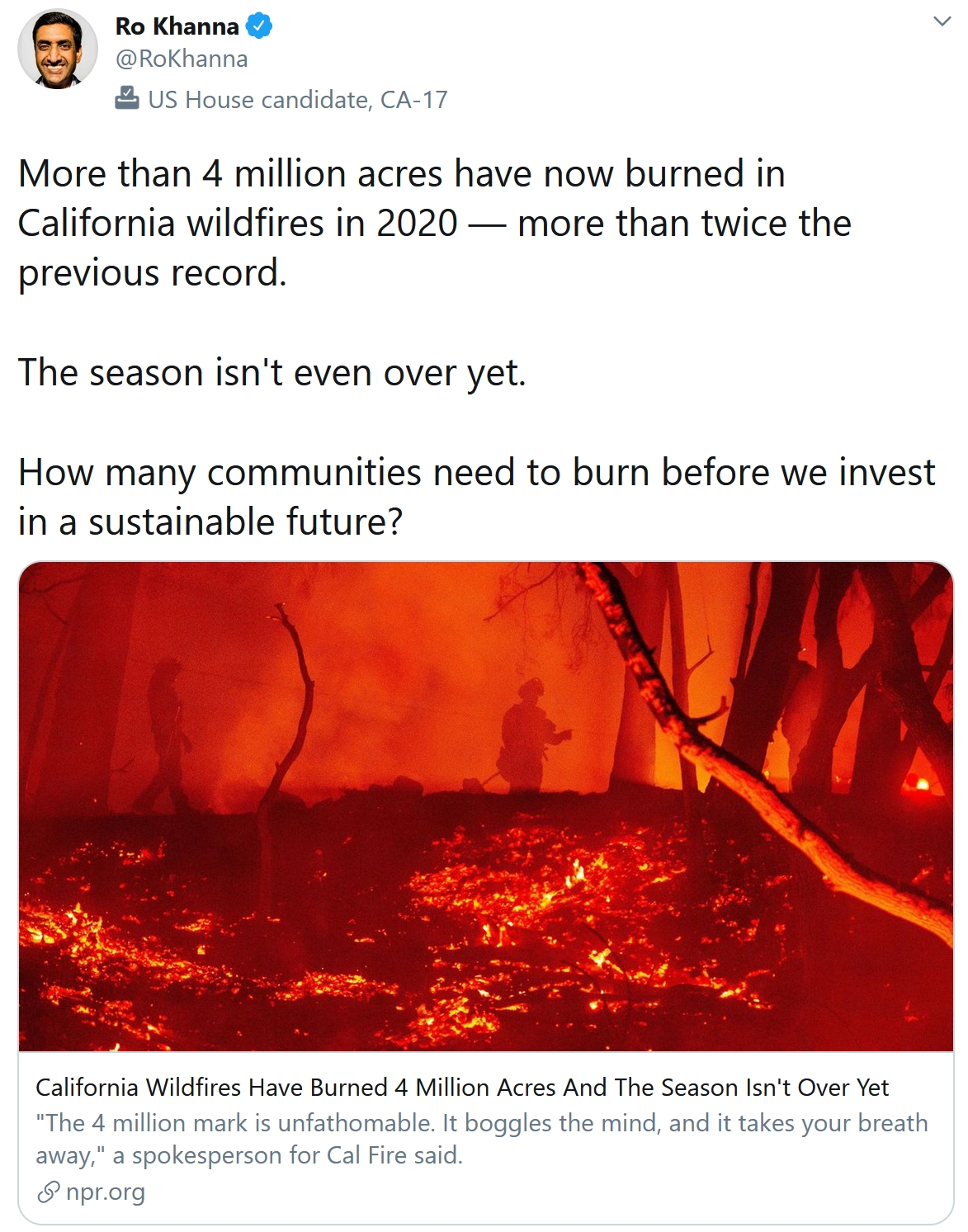
The Frightening Implications of California’s First Million-Acre Wildfire. The Los Angeles Times connects the dots; here’s an excerpt: “…The August Complex has contributed to the worst fire season California has ever recorded: 4 million acres in California have burned to date — far exceeding the previous record of more than 1.8 million set in 2018. One firefighter, Diane Jones, 63, lost her life trying to battle the blaze. “This is a wake-up call,” said Bill Patzert, a climatologist who spent several decades at the NASA Jet Propulsion Laboratory in La Cañada Flintridge. “California burns every year, but it didn’t burn a half a century ago like it is today. The stage is evolving.” Increased global temperatures driven by carbon emissions also contributed to 2020’s extreme fire conditions. California saw its hottest August on record, only to break at least six more temperature records in September. Fourteen of the last 21 years have also seen below-average rainfall in the state...”
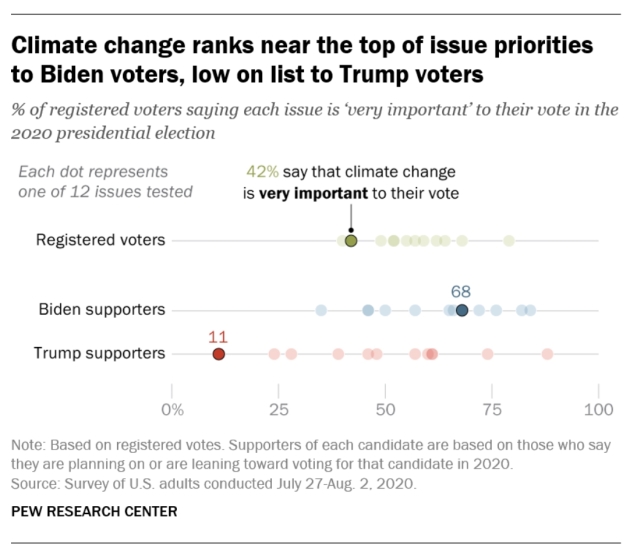
How Important is Climate Change to American Voters in the 2020 Election? Here’s an excerpt from Pew Research Center: “…The issue of climate change has been growing in importance for Americans over time. Six-in-ten adults now view climate change as a major threat to the well-being of the U.S. – up from 44% who said this in 2009. And a January survey – fielded before the coronavirus outbreak – found a rising share citing climate change as a top priority for the president and Congress. In both instances, rising concern has been concentrated among Democrats, but not Republicans. Still, the share of all voters who say climate change will be very important to their vote (42%) trails behind other leading issues such as the economy (79%), health care (68%) and the coronavirus outbreak (62%)...”
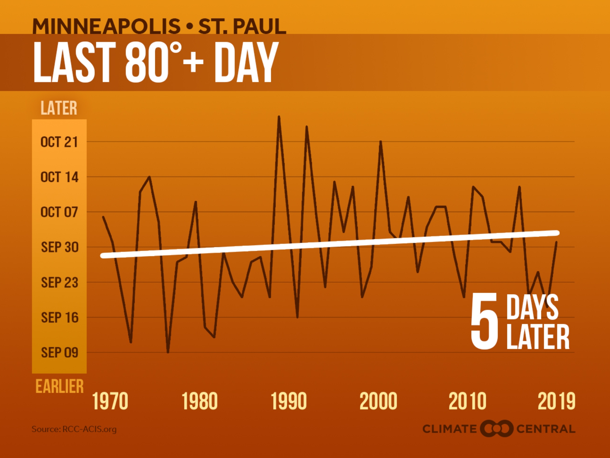
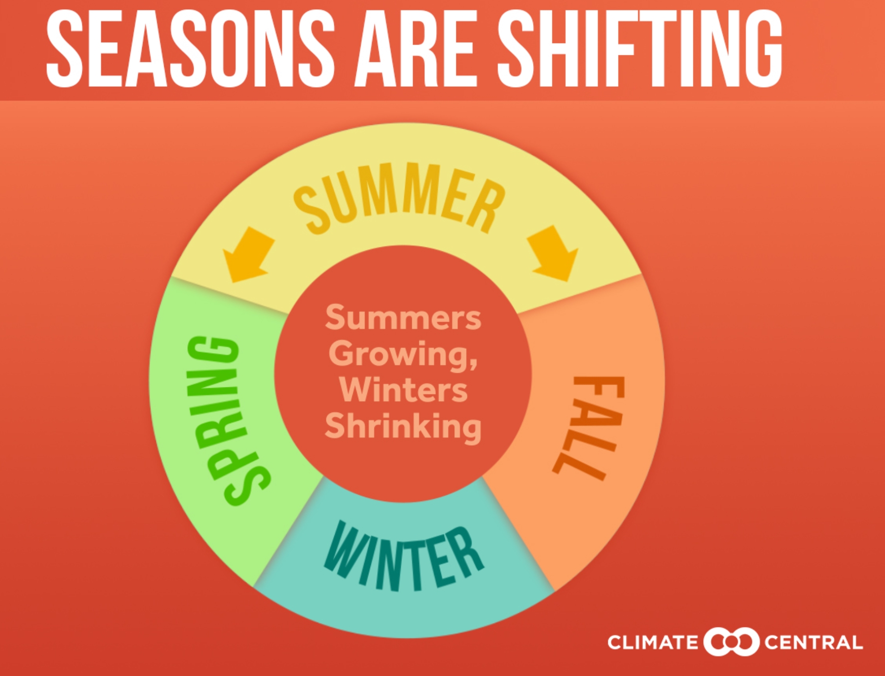
Lingering Summer Warmth. Not every year, but most years summer heat is pushing deeper into traditional autumn, according to an analysis at Climate Central: “A Climate Central analysis found that summer warmth is intruding upon our colder seasons, with 50% (122) of the cities analyzed recording summer temperatures that last a week or more longer than they did 50 years ago. The intrusion of summer warmth into our colder seasons is presenting a challenge for native plant and animal species whose life cycles are scheduled around the once-reliable seasonal changes of the temperate North American climate. Lingering warmth has implications for fall harvests and agriculture. Colder temperatures help to keep many invasive and pest species at bay, so the invasion of summer warmth into our colder seasons could favor crop weeds and pests— potentially resulting in losses for farmers…”
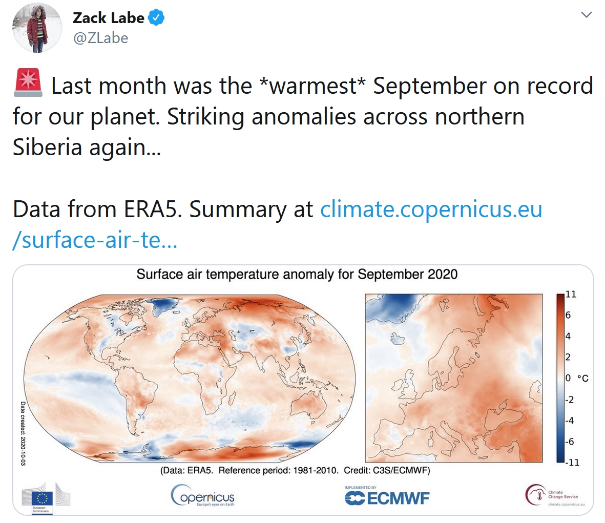
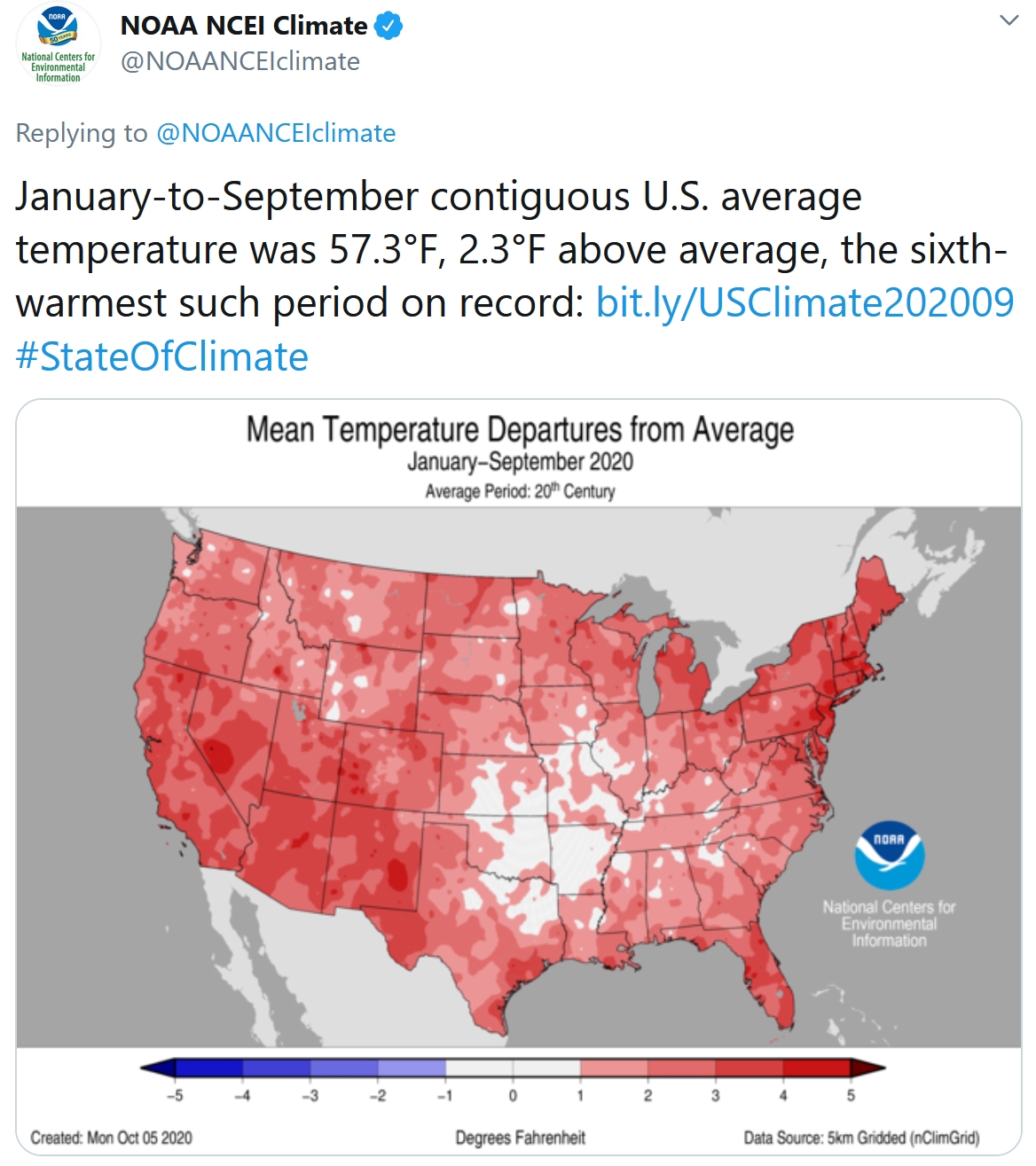
September Was World’s Hottest on Record, EU Climate Change Service Says. Reuters reports: “Last month was the world’s hottest September on record, with unusually high temperatures recorded off Siberia, in the Middle East, and in parts of South America and Australia, the European Union’s Copernicus Climate Change Service said on Wednesday. Extending a long-term warming trend caused by emissions of heat-trapping gases, high temperatures this year have played a major role in disasters from fires in California and the Arctic to floods in Asia, scientists say. Globally, September was 0.05 degrees Celsius warmer than the same month in 2019 and 0.08C warmer than in 2016, previously the warmest and second warmest Septembers on record, the Copernicus data showed...”