
Quick Summary
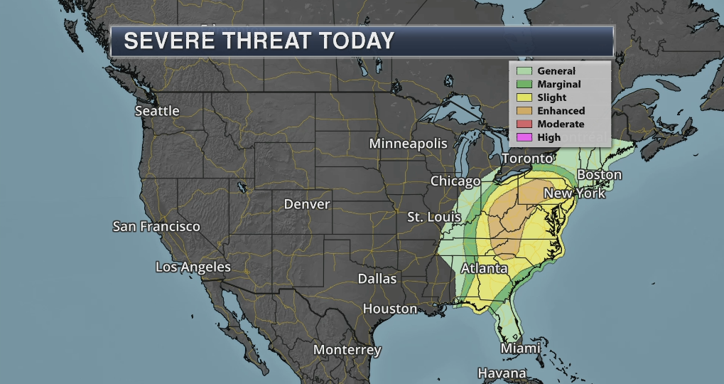
Severe storms hit much of the South-Central region on the United states yesterday (Saturday). Now… it is the east’s turn to be under the bull’s eye. We got a cold front racing into this region today (Sunday, April 14th). It will be churning up plenty of moisture from the Gulf of Mexico. We got ‘twisting’ winds with height, and the front will ‘run into’ more than enough developing instability to support plenty of strong-to-severe thunderstorms. Be weather aware and know that safe place to be if severe weather hits.
Looking At Maps (Updated 7:00 am central time)

Probability of a tornado within 25 miles of a point.
Hatched Area: 10% or greater probability of EF2 – EF5 tornadoes within 25 miles of a point.

Probability of damaging thunderstorm winds or wind gusts of 50 knots (~58 mph) or higher within 25 miles of a point.
Hatched Area: 10% or greater probability of wind gusts 65 knots (~75 mph) or greater within 25 miles of a point.
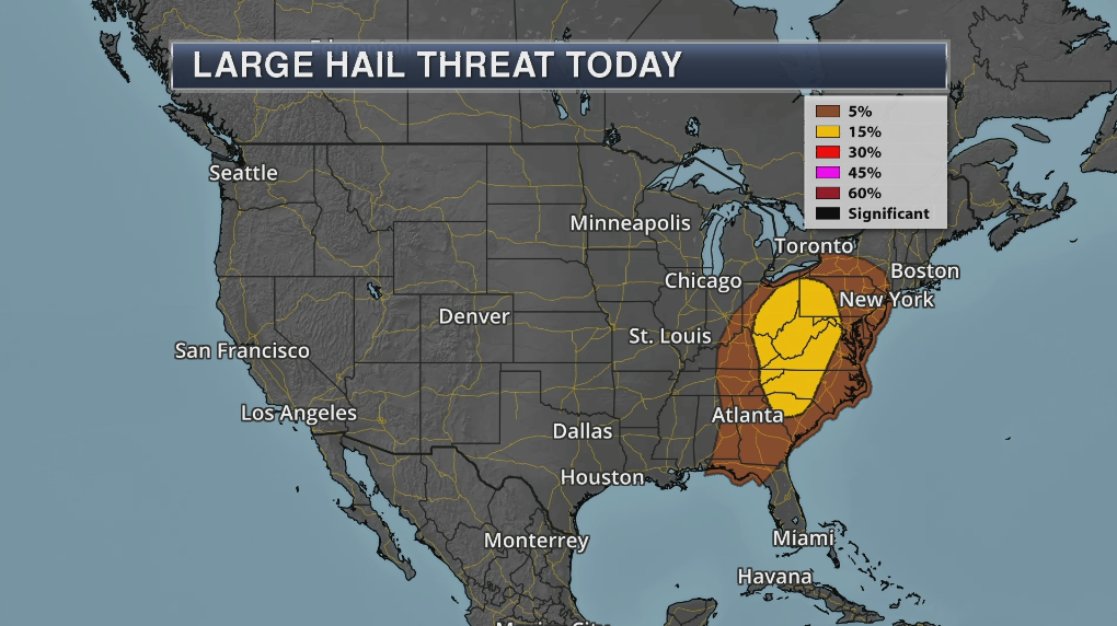
Probability of one inch diameter hail or larger within 25 miles of a point.
Hatched Area: 10% or greater probability of two inch diameter hail or larger within 25 miles of a point.
Looking Ahead (Updated 7:00 am central time)


Note: A severe storm weather area depicted above indicates a 15%, 30% or higher probability for severe thunderstorms (e.g. a 15%, 30% chance that a severe thunderstorm will occur within 25 miles of any point).
Stay classy, fellow weather nerds.
Meteorologist Joe Hansel
Follow me on Instagram, Facebook & Twitter.
