
Meteorological Comfort Food Returns Next Week
I’ve never needed coping skills more than I do in 2020 – and I suspect I’m not alone. Prayer, comfort food, a few good novels, kayaking and Netflix (without the chill).
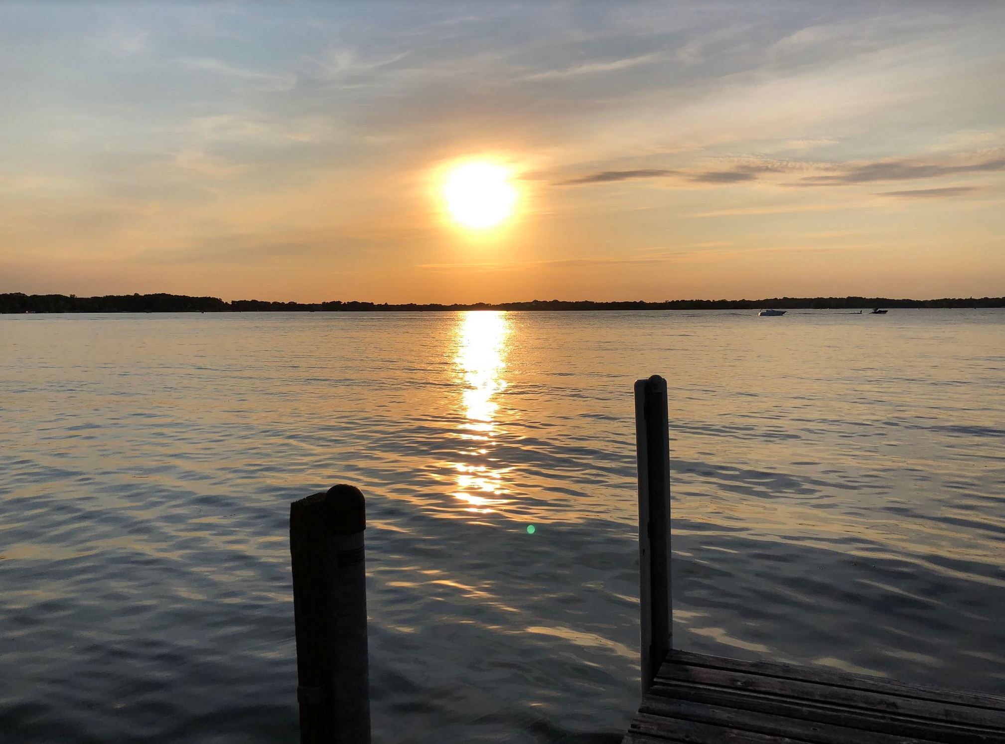
Physical distancing is so much easier (and more fun!) on a Minnesota lake in August than shoveling icy
sidewalks in January. Are we dreading winter more than usual this year? Perhaps. I find perpetual uncertainty to be mentally exhausting.
This week’s premature cool slap was a reminder that any lukewarm days are fleeting and numbered. Take advantage of any wayward warm fronts in the coming weeks.
As usual, I’ve buried the lede: a streak of 70s is shaping up next week. We may even see a few 80s before flakes begin to fly. Summer isn’t quite done with us yet.
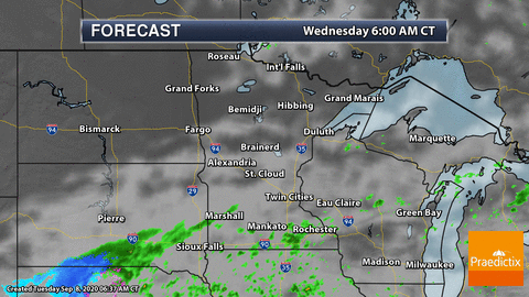
In the short term, a wave of low pressure spreads rain back into the area today, and more pop-up showers and T-storms will freckle the Doppler radar screen late Friday and Saturday.
But September often brings postcard perfect skies. That should become evident next week.
The Dominance of Chaos. An accurate forecast 4 months into the future? Don’t hold your breath. At the end of the day meteorologists are up against chaos theory, as a story at Mashable explains; here’s an excerpt: “…Yet, there’s a limit on how far into the future humanity can ever predict the day-to-day weather: Will a storm probably hit my town? Will it be a terrible day for a barbecue? Will driving be too dangerous? The absolute limit on this type of weather prediction is somewhere between two and three weeks, said Falko Judt, a research meteorologist at the National Center for Atmospheric Research. Even the relentless march of technology — with ever faster, better, smarter computers — cannot push beyond this boundary. “It’s the natural limit,” said Judt, who in 2018 tested the limits of weather prediction on a supercomputer running sophisticated algorithms to simulate Earth’s atmosphere. “It’s inherent to the atmosphere,” explained Judt. “It’s something that is set by nature itself...”
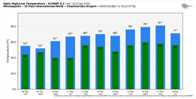
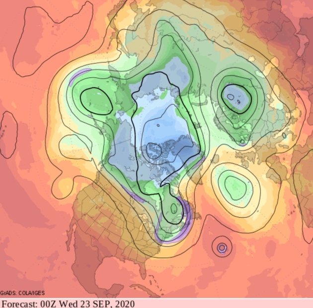
Make Me Smile. Please ECMWF, don’t play with me. The European model predicts a run of 70s next week, even a shot at 80s one week from tomorrow. MSP Meteogram: WeatherBell.

Praedictix Briefing: Issued Tuesday, September 8th, 2020:
Extreme Fire Danger
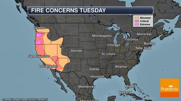
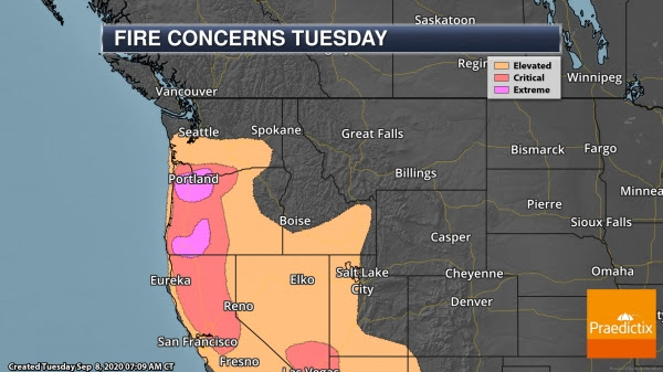
Extreme Fire Danger Today. A closed low across the Intermountain West along with troughs along the West Coast and Desert Southwest are causing a tight pressure gradient across portions of the western United States today. This is leading to strong winds, which, in combination with very dry fuels across the region and low humidity are leading to at least critical fire conditions. Across portions of the Pacific Northwest, including in the Portland and Medford areas, an Extreme Fire Danger is in place today due to these conditions and multiple large fires already ongoing across the region. Rapidly moving wildfires are expected.
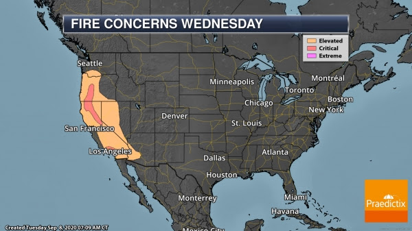
Fire Danger Continues Wednesday. Critical fire danger will continue across the western United States Wednesday due to the continued low humidity values, gusty winds, and very dry fuels.
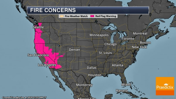
Fire Weather Warnings. Due to the expected volatile fire weather conditions across the western United States, areas from Washington to Arizona are under Fire Weather Warnings.
Get more information on wildfires burning out west from:
- CalFire (California only): https://www.fire.ca.gov/incidents/
- InciWeb: https://inciweb.nwcg.gov/
September Snowstorm
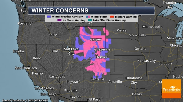
Winter Storm Warnings. That same closed low across the Intermountain West helping to create fire weather concerns is also bringing cold air and a September snowstorm across the Rockies into the Front Range over the next couple of days. Winter Weather Advisories and Winter Storm Warnings are in place across the region, including in the following areas:
- Casper, WY: Winter Storm Warning through Noon Tuesday for 4-8″ of snow and wind gusts to 35 mph.
- Cheyenne, WY: Winter Storm Warning through 6 AM Wednesday for 5-10″ of snow and wind gusts up to 45 mph.
- Denver, CO: Winter Weather Advisory through Noon Wednesday for 3-7″ of snow and wind gusts to 35 mph.
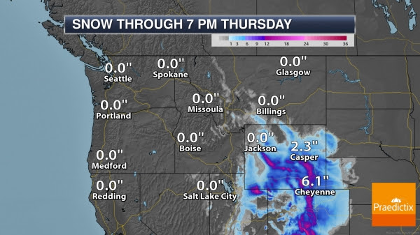
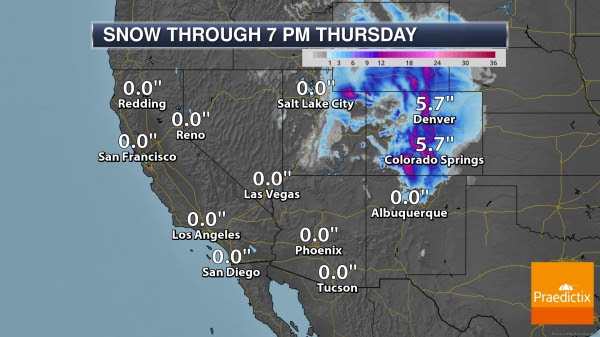
Additional Snow Forecast. The heaviest snow will fall in the mountains at higher elevations where over a foot could be possible. The heaviest snow in Cheyenne will fall during the daytime hours today, tapering off tonight (especially after midnight). The highest chance of accumulating snow in Denver will be from this afternoon through the morning hours Wednesday.
Atlantic Tropical Update

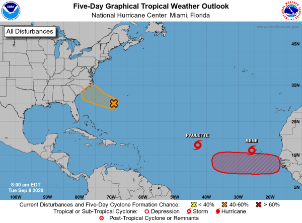
Paulette, Rene, And Tropical Waves. As we look at the Atlantic, we are tracking two named system out in the central and eastern Atlantic. Tropical Storm Paulette poses no threat to land over the next five days as it continues to move west-northwest to northwest. Tropical Storm Rene is moving across the western Cabo Verde Islands and will continue to produce tropical storm force winds and heavy rain across the islands today. It should strengthen into a hurricane later this week, but curve northward and not be a threat to land once it moves past the Cabo Verde Islands. We are also tracking an area of low pressure about 300 miles west-southwest of Bermuda which has showers and thunderstorms but remains disorganized. There is about a medium chance (40%) this area of low pressure could form into a tropical depression as it approaches the Southeast U.S. coast in about two to three days. Meanwhile, another tropical wave will move off Africa by Thursday and has a high chance of formation (70%) in the next five days. Models are keeping whatever comes of this wave farther south, so it will be one to watch heading into next week.
D.J. Kayser, Meteorologist, Praedictix
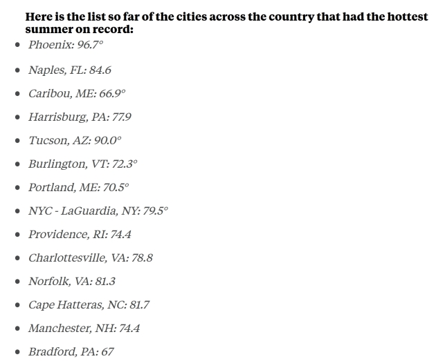
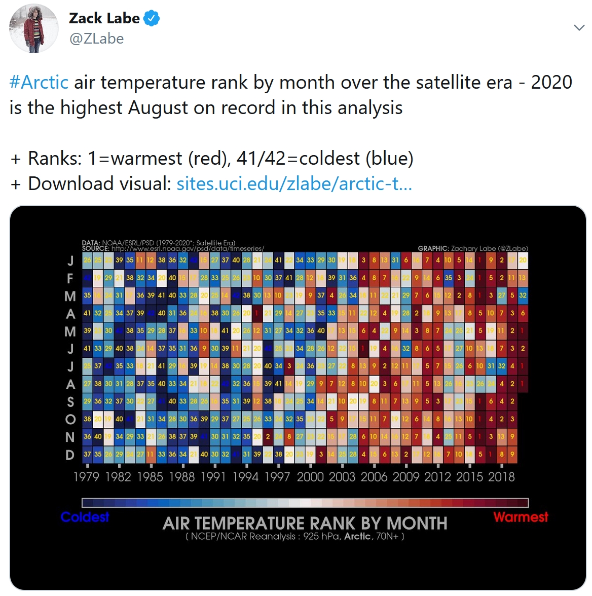
2020 Was Hottest Summer on Record for Dozens of US Cities. ABC News explains: “…Some of the nation’s largest cities recorded their hottest climatological summers on record this year, including destinations like Phoenix, Tucson and Sacramento, according to the National Weather Service. In Phoenix, the country’s sixth-largest city, residents saw average temperatures of about 96.7 degrees — almost 1.6 degrees above the previous summer record, the NWS said Wednesday…Meanwhile, cities like Palm Springs, Las Vegas, Vero Beach, Florida, Flagstaff, Arizona and Sarasota, Florida, saw their hottest August temperatures ever...”
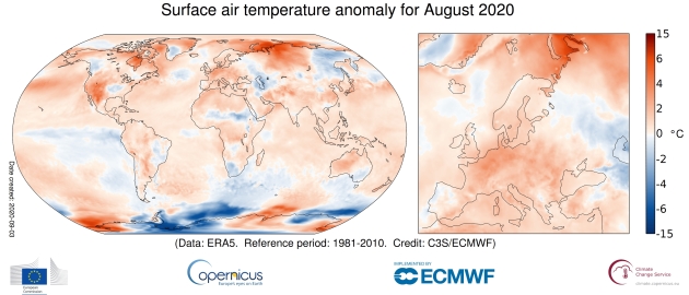
August 2020 Heat: World’s Fourth Warmest on Record. Bloomberg reports: “August 2020 will go down as the fourth-warmest on record worldwide, with above average summertime heat in the U.S. and Mexico tempered slightly by below average temperatures in parts of the Southern Hemisphere. Global temperatures for the month spiked around 0.9 degrees Celsius above the historical average, according to a new report by Europe’s Copernicus Climate Change Service. That reading came in lower than the summers of 2018 and 2019, the agency said in a statement...”
Image credit: Copernicus.
2020: One of the Four Warmest Summers on Record for Minnesota. So says Dr. Mark Seeley at Minnesota WeatherTalk: “…On a statewide basis this was one of the top 4 warmest summers in history (since 1895, averaging nearly 3 degrees F above normal for all three months combined. The summer of 1988 remains the warmest in state history, but 2020 will follow close behind with 1933 and 1983. Within the climate station network of Minnesota this summer 135 daily maximum temperature records were set or tied, while 143 warm daily minimum temperature records were set or tied. The highest temperature was 102°F at Granite Falls on June 7th. In addition, Benson, Sabin, Artichoke Lake, Milan, and Morris all reported at least one day with 100°F as well...”
Photo credit: Paul Douglas.

Lessons from the 1918 Spanish Flu Pandemic: Survival Does Not Mean That Individuals Fully Recovered. A story at Marketwatch caught my eye; here’s the introduction: “There’s still so much we don’t know. There is a cautionary note from the 1918 flu that has resonance in 2020, and it could reinvigorate social-distancing and mask-wearing behavior among those people who are feeling the fatigue of disruption to their daily lives: “While 1918 was deadly, most that contracted the virus survived. But survival does not mean that individuals fully recovered.” That’s according to a review of literature and studies on the 1918 flu by economists at Vanderbilt University in Nashville, Oberlin College in Oberlin, Ohio, and Carnegie Mellon University in Pittsburgh. “The evidence suggests that, in 1918, those that survived the initial infection faced an elevated mortality risk and some physiological conditions never fully healed…”
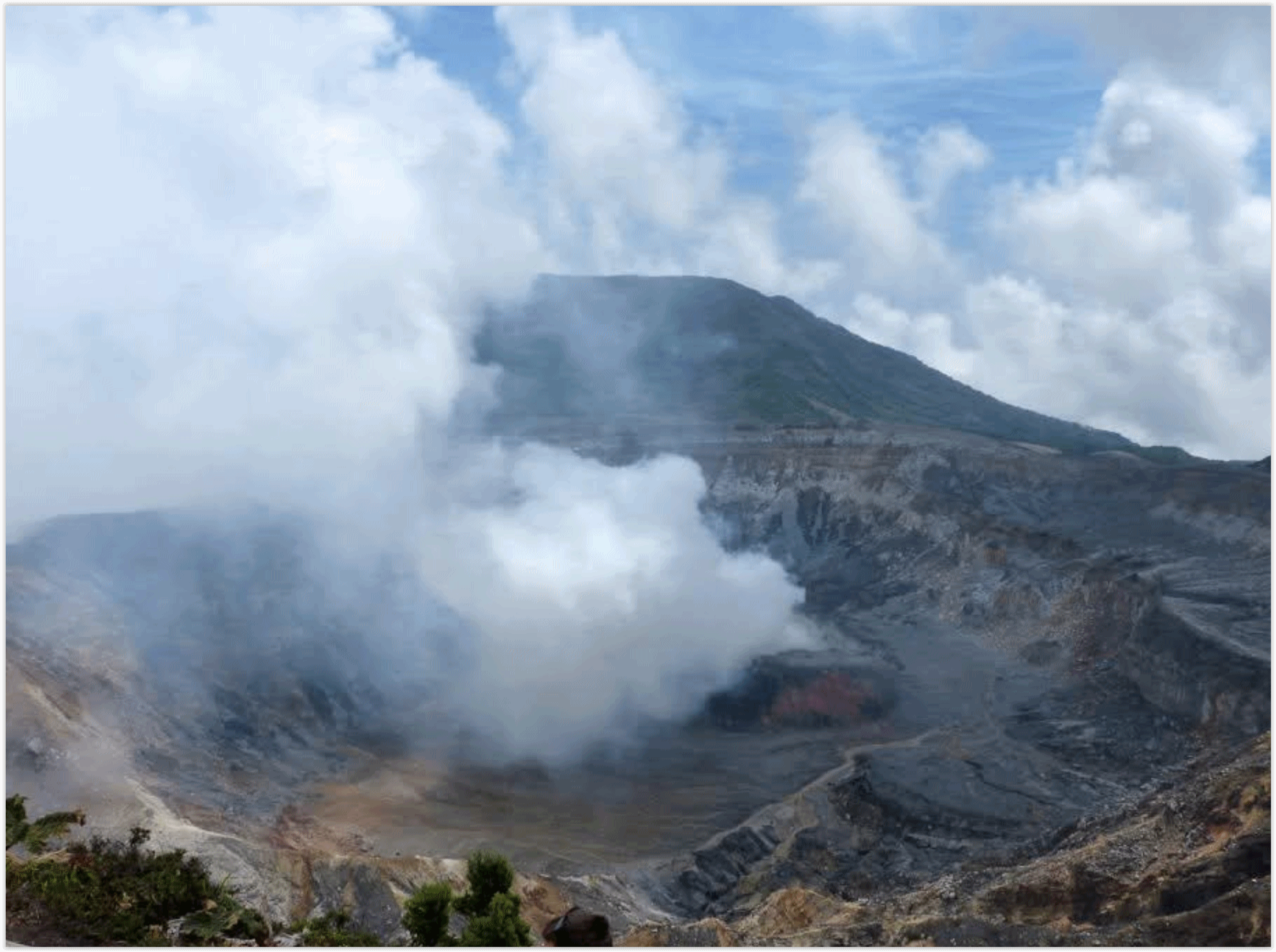
How to Escape From an Erupting Volcano. Because 2020. Here’s an excerpt from WIRED.com (paywall): “Let’s say you were visiting the Roman town of Pompeii on the morning of August 24, 79 AD. And let’s say you arrived sometime between the hours of 9 and 10 am. That should give you enough time to explore the port town and maybe even grab a loaf of bread at the local bakery (see map below for directions). But it would also put you in Pompeii in time to experience a 5.9 magnitude earthquake, the first of many, and watch the black cloud rise from Mount Vesuvius as the mountain began to erupt 1.5 million tons of molten rock per second and release 100,000 times the thermal energy of the bomb dropped on Hiroshima. All while you were standing a mere 6 miles away...”
Arenal volcano in Costa Rica file image: Susie Martin, Praedictix.

How to Handle a Jerk. I needed this advice from The Wall Street Journal (paywall) now more than ever. This applies to social media, too. Don’t engage, just mute, block or walk away. Here’s an excerpt: “…Dealing with an everyday jerk is a two-part process. Part one: Do not engage. Once the jerkiness comes out—in your example, when the guy began berating you for pointing out his error—separate yourself from the encounter. Remember: You’re extremely unlikely to change someone else’s bad behavior. And the more you call that person out, the more likely he or she is going to get defensive and double down on it. Keep calm and remain polite. Remove yourself physically if possible. Take some comfort in the fact that unless the person is a straight-up sociopath, he or she probably feels some sense of shame when left alone acting like an idiot...”
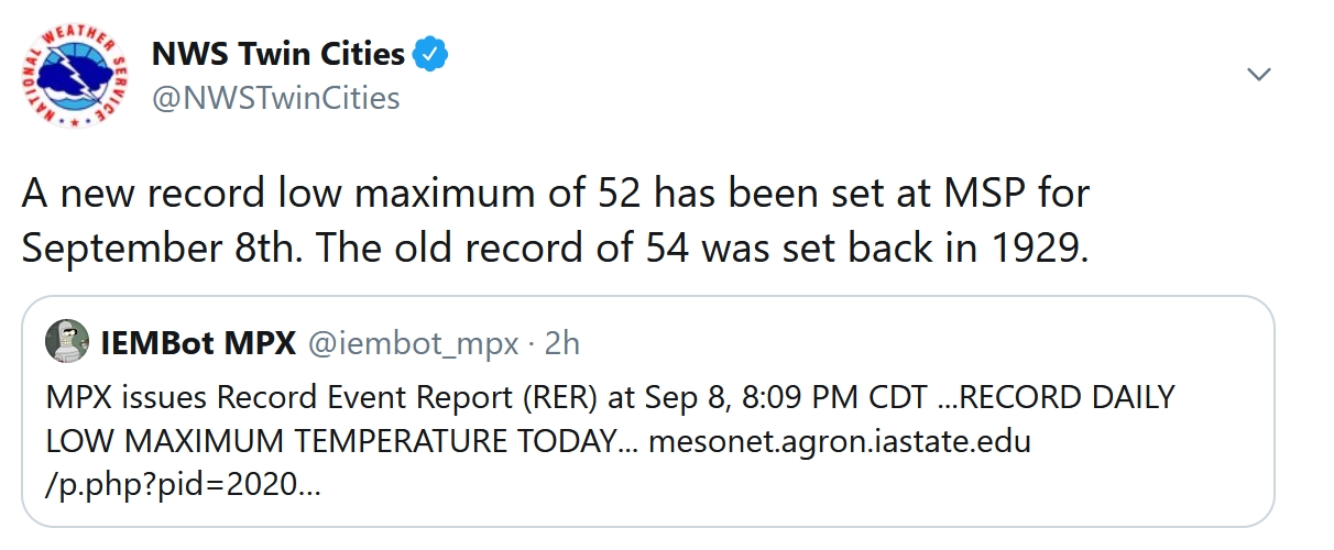
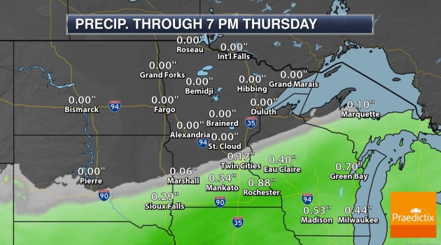
52 F. high in the Twin Cities (a new record for chilliest daytime high on record for September 8)
75 F. average high at MSP.
62 F. high on September 8, 2019.
September 9, 1979: 1 3/4 inch hail falls in Douglas County.
September 9, 1917: Very chilly air moves into Minnesota, with a low of 17 degrees at Roseau.
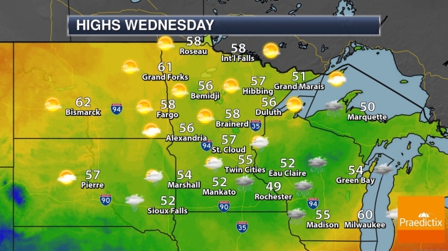
WEDNESDAY: Chilly with light rain. Winds: SE 3-8. High: near 50
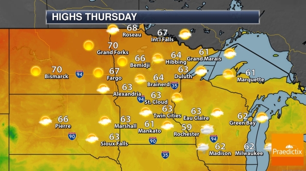
THURSDAY: Mix of clouds and sun, better. Winds: S 5-10. Wake-up: 42. High: 61
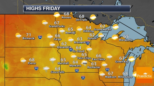
FRIDAY: Sunny start, late showers, storms. Winds: SE 10-15. Wake-up: 46. High: 67
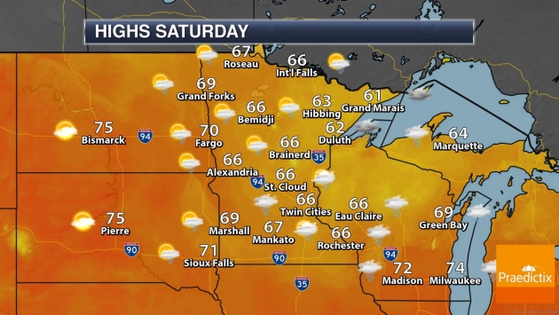
SATURDAY: Unsettled, few showers and storms. Winds: W 10-20. Wake-up: 56. High: 68
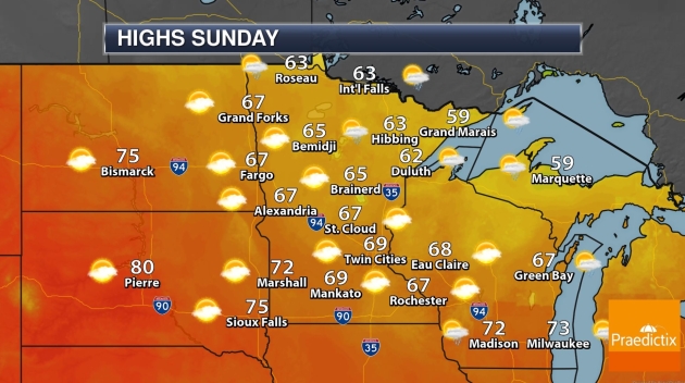
SUNDAY: Partly sunny, breezy. A nicer day. Winds: NW 10-20. Wake-up: 54. High: 71
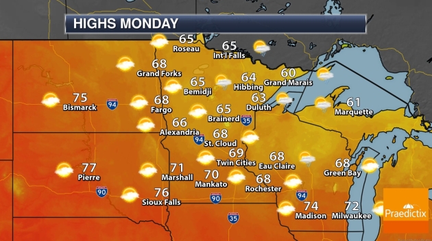
MONDAY: Patchy clouds, risk of a T-shower. Winds: SE 10-15. Wake-up: 51. High: 69
TUESDAY: Blue sky, take the Zoom call outside. Winds: S 10-20. Wake-up: 56. High: 76
Climate Stories…
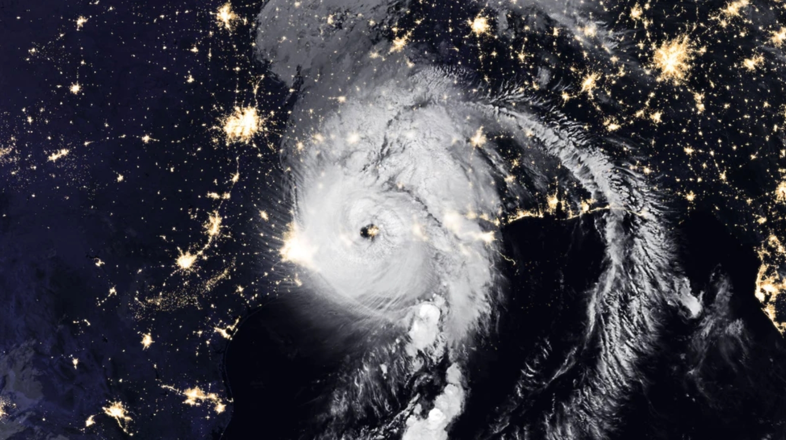
Catastrophic Hurricanes are “The New Normal” and They Will Cost Trillions. A post at VICE examines the trends with costly hurricanes and how a warmer world may supersize storms to come: “…Since 2005, the US federal government has paid out roughly $30 billion a year to respond to extreme weather disasters. But from 2016-2018, the US has experienced disaster costs on average exceeding $150 billion a year. And total damages to the US mainland from the 2017 Atlantic hurricane season (comprising hurricanes Harvey, Irma, Jose and Maria) amounted to some $265 billion. These costs are set to increase dramatically if global average temperatures continue to rise. The EDF report notes that every 1° Celsius (C) of warming will generate roughly $257 billion of costs to the US every year from extreme weather impacts…That means that on a business-usual-trajectory, when we hit another 1°C higher to reach around 2°C of warming, annual US disaster relief expenditures will more than double to around $514 billion…”
Hurricane Laura file image: NOAA.
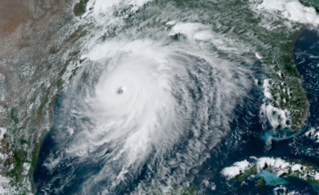
Is Rapid Intensification of Hurricanes Becoming More Common? Here’s an excerpt of an explainer from The Conversation and Honolulu Civil Beat: “…Because rapidly intensifying hurricanes are fairly rare, there isn’t enough information yet to say if rapid intensification is happening more often. The hurricane research community has consistent, reliable observations of storm intensity only since the start of the satellite era and routine storm-penetrating “hurricane hunter” flights since the 1970s. We have seen more rapid intensification events in recent years, and some scientists have concluded that the warming climate is likely playing a role. However, we’ve also had more active hurricane seasons in those years, and more work needs to be done in this area to understand global trends, such as why hurricanes are crossing ocean basins more slowly…”
Image credit: “Hurricane Laura intensified quickly over the Gulf of Mexico before making landfall on Aug. 27.” CSU/CIRA and NOAA/NESDIS.
Natural Disasters Can Inspire Better Local Climate Change Policies – If They’re Notably Deadly or Weird. Climate change hits home…when it hits home. Here’s an excerpt from Fast Company: “…The main indicator of if there would be policy change, researchers found, was a high-impact weather event, which the researchers measured as being those with ten or more fatalities in one day, and which resulted in a Presidential disaster declaration. “A really impactful event matters to spark policy change,” Giordono says. From there, the researchers identified two “recipes” for local policy change: a high-impact event in a Democratic county with a lot of post-event media attention, and a high-impact event in a Republican county where the event was particularly unusual, either because it was not normal for the area in terms of type and timing or because it happened in a string of multiple other extreme weather events…”
Image credit NOAA CPO.
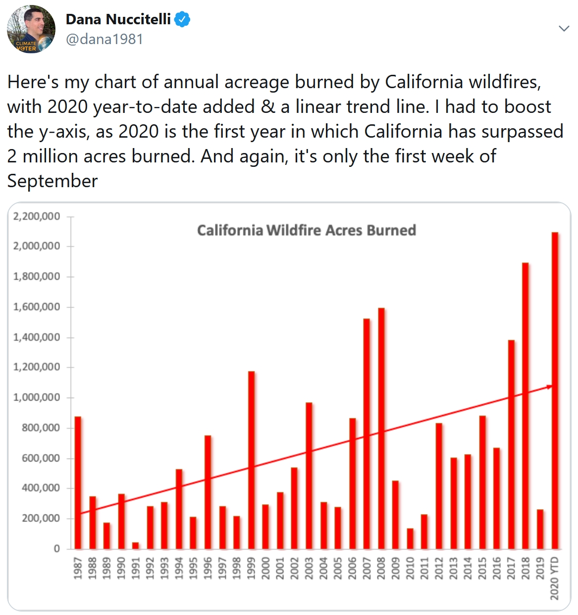
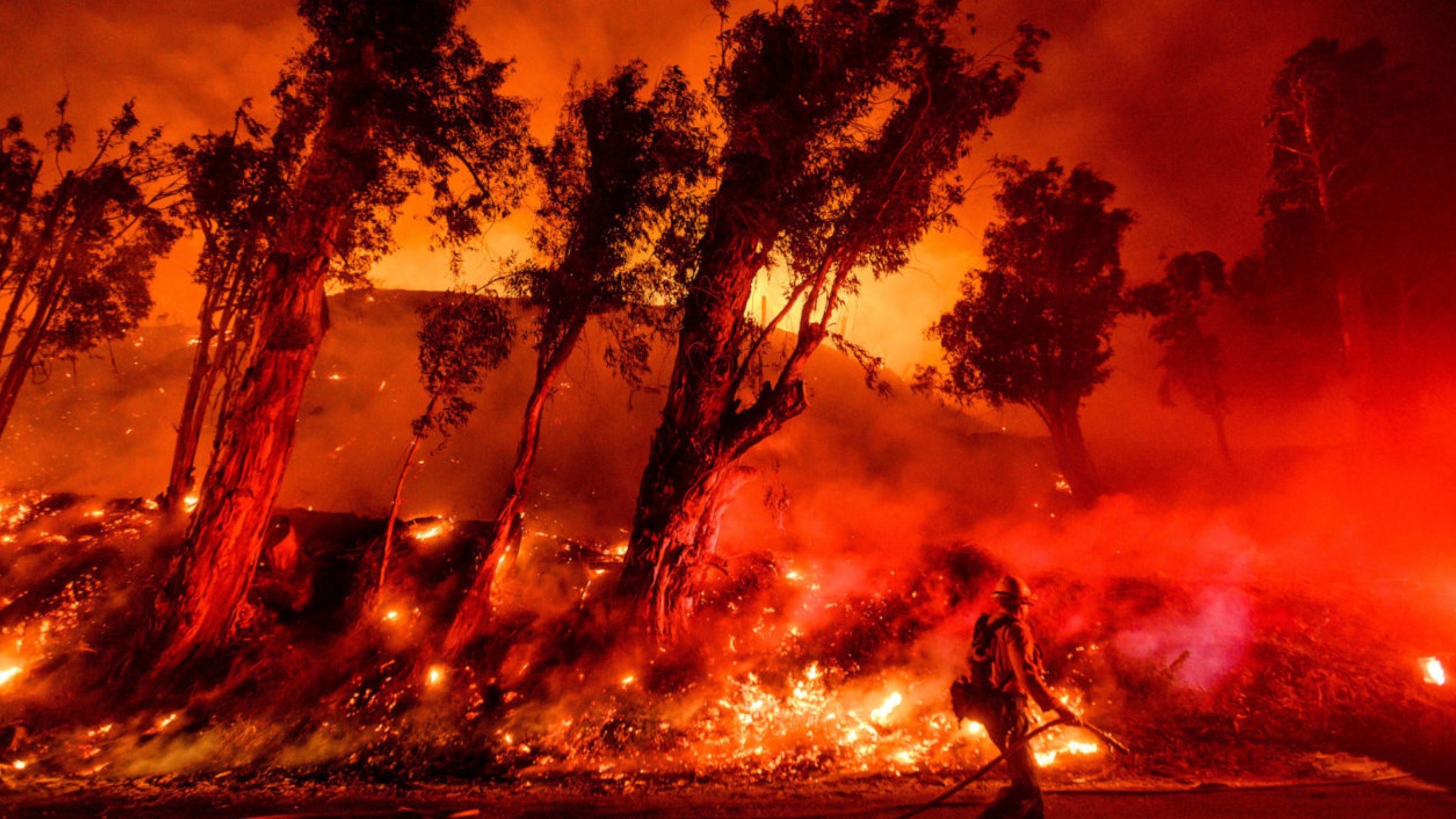
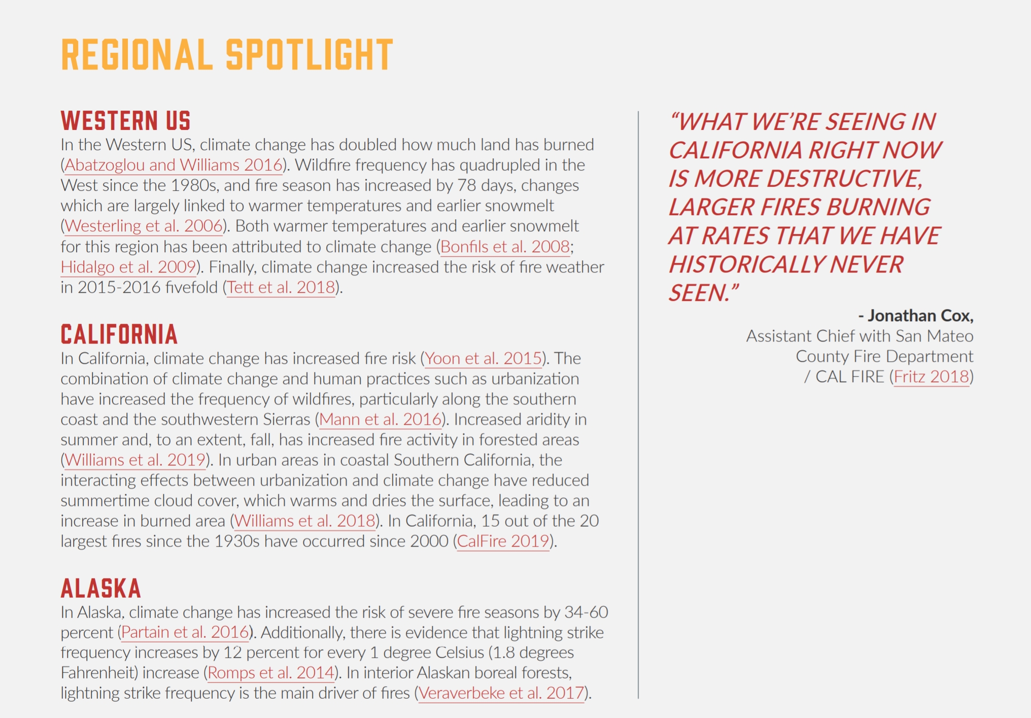
Wildfire Threat is Bad and Getting Worse in the American West. An Op-Ed at Star Tribune caught my eye: “…Looking farther ahead, the picture does not improve. As climate change worsens, wildfires are growing in number, scale and duration across the American West, overwhelming local firefighting capacities and putting property and lives in peril. Since 2017, fires have consumed more than 20 million acres and caused at least $50 billion in economic losses. The U.S. needs a coherent national strategy to address the threat. New resources, including extra staff, are essential if fires are to be fought more effectively. But prevention matters as well. Addressing climate change is vital, but other kinds of mitigation are possible too...”
File image credit: Washington State DNR.
New Research Show Immportance of Military Personnel Communicating the Risks of Climate Change. Here’s the intro to a post at The Center for Climate & Security: “While senior military leaders, due to their apolitical reputation, can influence skeptical audiences about climate change risks to national security, enlisted personnel can be even more persuasive when they deliver personal messages, according to new research in the peer-reviewed journal Environmental Communication. The experimental study examined how to construct a climate change communication strategy using a pro-climate framework, and focused around national security concerns delivered by enlisted military personnel to groups who are more prone to skepticism regarding the scientific consensus on climate change.The bottom line up front from the study is simple: active duty U.S. military personnel are increasingly concerned about climate change, and that evidence-based perspective is influential with conservatives...”
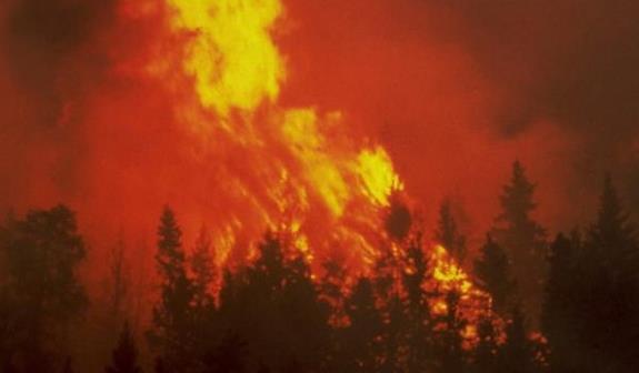
Climate Whiplash: Wild Swings in Extreme Weather Are on the Rise. Yale E360 explains: “…These wild swings from one weather extreme to another are symptomatic of a phenomenon, variously known as “climate whiplash” or “weather whiplash,” that scientists say is likely to increase as the world warms. The intensity of wildfires these days in places like California are a symptom of climate change, experts say, but the whiplash effect poses a different set of problems for humans and natural systems. Researchers project that by the end of this century, the frequency of these abrupt transitions between wet and dry will increase by 25 percent in Northern California and as much as double in Southern California if greenhouse gasses continue to increase…”
File photo: “Firefighters battle the Maria Fire in Santa Paula, California on November 1.” AP Photo/Noah Berger.
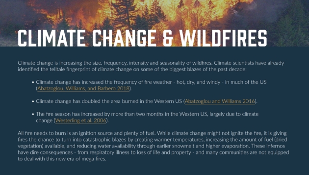
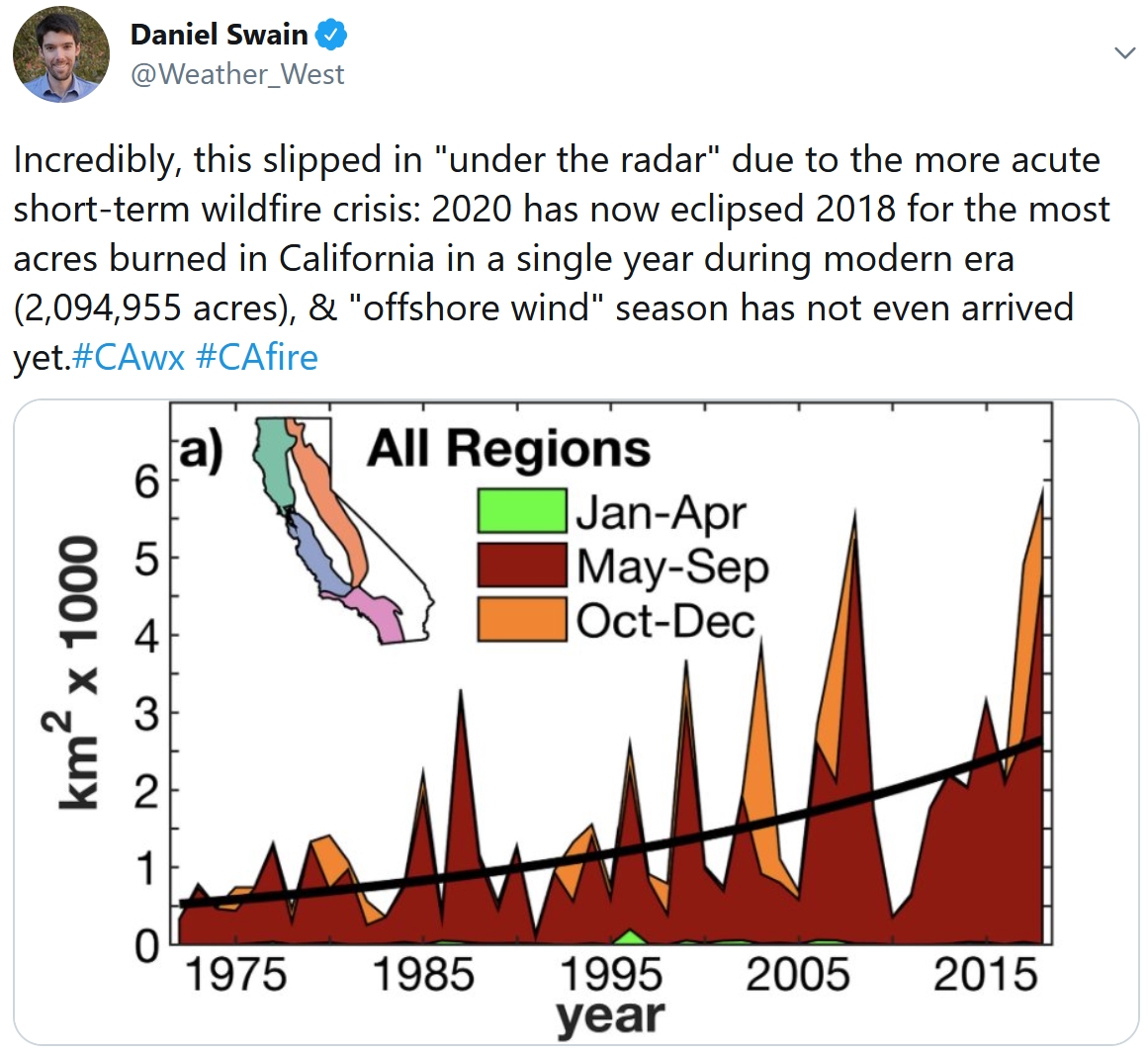
Connecting the Dots. A consistently hotter, drier climate is helping to fan the flames of larger, longer, more extreme fires, especially California. Graphics above courtesy of Envent Lab.
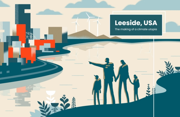
Leeside, USA: The Making of a Climate Utopia. There is no Leeside (yet) but every community will have to use new methods and materials to build resilience, no matter what a more volatile climate throws at us. Here’s an excerpt from Quartz: “It’s 2057 and no life has been untouched by the realities of a warming globe. But mere decades ago, at the dawn of the 21st century, Americans were only just waking to this truth. Rising seas, powerful storms, and raging fires were destroying their cities, rendering homes uninhabitable, and dismantling livelihoods. Residents affected by such loss began to ask, “Where will we go?” In an increasingly isolationist world, many responded, “Not here.” But Leeside opened its doors. And after years of implementing innovative policies benefiting both the environment and the city’s residents, the United Nations inaugurated Leeside as the United States’ first Green Haven in 2035. Now, the city is recognized as a model of successful adaptation—physical, economic, and social—to a world in which cities and their communities are transformed by the millions seeking shelter from the storm...”
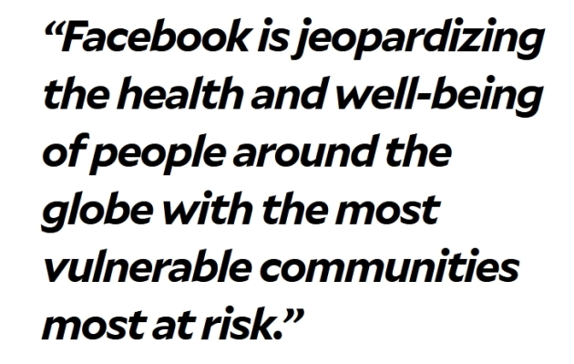
Democratic Leaders Want to Know Why Facebook’s New Oversight Board Won’t Deal with Climate Lies. Seems like we have an algorithm (or oversight) problem, according to Mother Jones: “…The dispute is over a loophole in Facebook’s leaky fact-checking operation that has allowed climate change deniers to circumvent fact-checkers and spread misinformation meant to mislead readers about the reliability of climate modeling. E&E News’ Scott Waldman reported how the denier group CO2 Coalition has been able to run ads on Facebook based on claims that aren’t supported by peer-review climate science. In one instance last year, Waldman found that independent fact-checkers flagged the post as false, temporarily blocked it, but a conservative staffer at Facebook overrode them to remove the false label. Ever since, the CO2 Coalition was able to share its false content because Facebook categorized it as “opinion” and therefore exempt from fact-checking...”
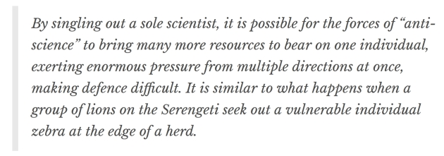
IPCC: the Dirty Tricks Climate Scientists Faced in Three Decades Since First Report. The Conversation lays out a persistent campaign of deception and disinformation: “…In 1996, there were sustained attacks on climate scientist Ben Santer, who had been responsible for synthesising text in the IPCC’s second assessment report. He was accused of having “tampered with” wording and somehow “twisting” the intent of IPCC authors by Fred Seitz of the Global Climate Coalition. In the late 1990s, Michael Mann, whose famous “hockey stick” diagram of global temperatures was a key part of the third assessment report, came under fire from right-wing thinktanks and even the Attorney General of Virginia. Mann called this attempt to pick on scientists perceived to be vulnerable to pressure “the Serengeti strategy”…”