
A is for Andres
Tropical Storm Andres is the new number one.
The then-named Tropical Depression One-E became Tropical Storm Andres early Sunday (May 9th) morning. ‘One-E’ is a name only a mother could love. Happy Mother’s Day. Mom gets a tropical storm.
Andres is notable for becoming the earliest tropical storm on record for the eastern Pacific Basin. Replacing Tropical Storm Adrian (2017) in the record books.
A Tropical Storm For Now
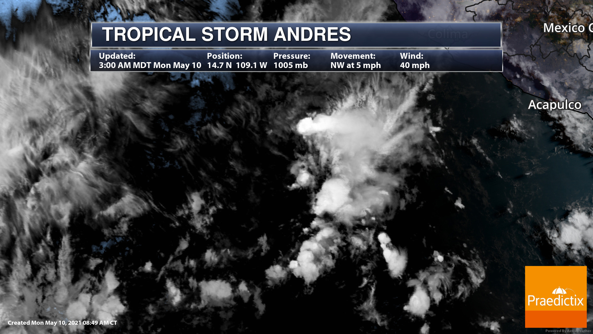
TS Andres Visible Satellite Imagery. Time 3AM MDT Monday, May 10th.
Above you will see TS Andres on visible satellite imagery spinning away before sunrise this Monday morning. For reference, you will see portions of SW Mexico. Andres will not stay a named storm for long. It will not impact land. Weakening is expected soon (if not already).

TS Andres Forecast path and intensity. Time 3AM MDT Monday, May 10th.
There are no coastal watches or warnings in effect.
From the National Hurricane Center, “3 a.m. MDT, the center of Tropical Storm Andres was located over the eastern North Pacific Ocean about 570 miles (915 km) south of the southern tip of Baja California. It’s moving northwest near 5 mph (7 km/h), and this general motion is expected to continue today.
Maximum sustained winds are near 40 mph (65 km/h) with higher gusts. Tropical-storm-force winds extend outward up to 80 miles (130 km) from the center. Gradual weakening is forecast to begin later today, with Andres expected to become a remnant low on Tuesday.”
What Is Next For Andres
The simple answer: nothing.
I do not underestimate how soon 2021 got a TS here. It is a record. Humans have never seen a tropical storm this early in the year for specifically the eastern Pacific Basin before. I would bet this trend continues in my lifetime. Tropical Storm Andres is the new number one. But I bet it will not be the last.
The frequency of named storms developing sooner-and-sooner during hurricane season is significant. Andres would otherwise not be a notable tropical storm. It is expected to weaken and ‘merge’ back into the general east-to-west atmospheric wind flow over the open Pacific soon. It is no threat to people or land in the forecast. We are fortunate this time.
Who is Praedictix? We are a weather company that focuses on delivering credible weather forecasts to our clients. We have three main offerings: media, weather graphics, and weather consulting.
Media: With two HD studios, we’re able to create professional weather forecast videos for use in television, social media, apps, and websites. Our forecasts are tailored to our clients’ brand. Our content ranges from national to hyperlocal forecasts and air all over the country.
Weather Graphics: We have access to a robust weather dataset which allows us to create high customizable, HD weather maps and graphics for use in television, digital signage, social media, and websites. Our white-label graphics allow our clients to push their own brands and sponsors.
Consulting: We lend our weather expertise to our clients to help with risk mitigation and business optimization by way of conference calls, emails, and briefings. We also have a forensic meteorology team that specializes in forensic weather analysis and expert testimony.
Click right HERE to learn more about us or contact us for your weather needs.

Joe Hansel
Lead Broadcast Meteorologist
Joe graduated with a bachelor’s in meteorology with a minor in mathematics from the University of North Dakota in Grand Forks. He also interned at Studio One in UND while earning awards as a student broadcaster and teaching assistant along the way. During summers off from college, Joe was the weather intern for the KSTP weather team based in the Twin Cities. Joe then worked as the morning meteorologist for 2 years at KCWY in Casper, Wyoming; then 4 years as the morning meteorologist at WSJV in South Bend-Elkhart, IN. There, Joe became a Certified Broadcast Meteorologist (CBM) through the American Meteorological Society and still owns the earned seal.