
Spring has arrived and aside from greenery, blooms, and allergies, it also means severe weather. The peak of severe weather season varies from region to region, but we tend to see a significant increase in severe storms during the Spring months. March through May are notorious for being some of the most volatile months of the year for the southern United States.
So far it has been a tough season with 237 tornado reports and 27 tornado-related deaths (dwarfing 2018’s 10 tornado-related deaths) through April 16th, 2019.

2019 tornado statistics through April 16, 2019. Source: Storm Prediction Center.
In today’s Weather Graphics Spotlight, we’re featuring an assortment of our severe weather graphics as Severe Season is underway. At Praedictix, we generate thousands of weather graphics a day for our clients and our own internal use. A storm like this really shows the multitude of layers that are available with our system. Both static and looping weather maps are available as well as panel graphics. Every graphic can be uniquely customized to fit our clients’ needs and are delivered automatically via FTP, though other delivery options are available. Furthermore, we allow our clients to push their brand by use of watermarks and logo overlays. We’re not limited to severe weather graphics! A menu of our current graphics offerings can be found here. Don’t see what you’re looking for? Be sure to ask us about what you are needing!
Severe Weather Graphics

Radar and Warnings.

Radar, Satellite & Lightning
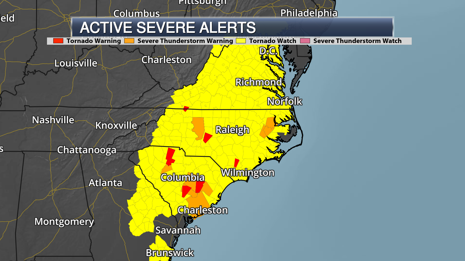
Severe Weather Watches & Warnings

Severe Weather Watches
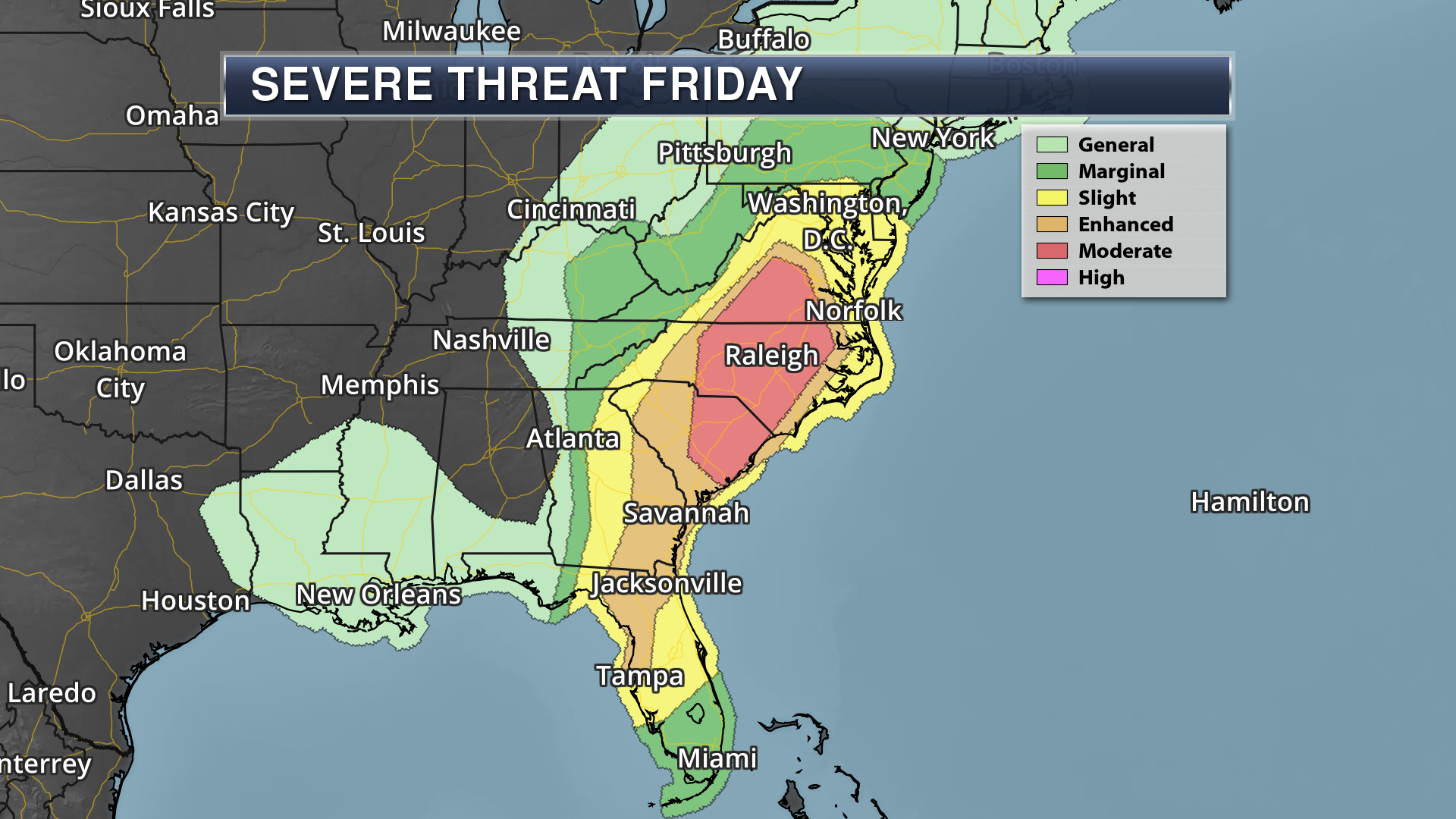
Storm Prediction Center (SPC) Convective Outlook on April 19th, 2019

Storm Prediction Center (SPC) Tornado Outlook on April 19th, 2019

Storm Prediction Center (SPC) Damaging Wind Outlook on April 19th, 2019
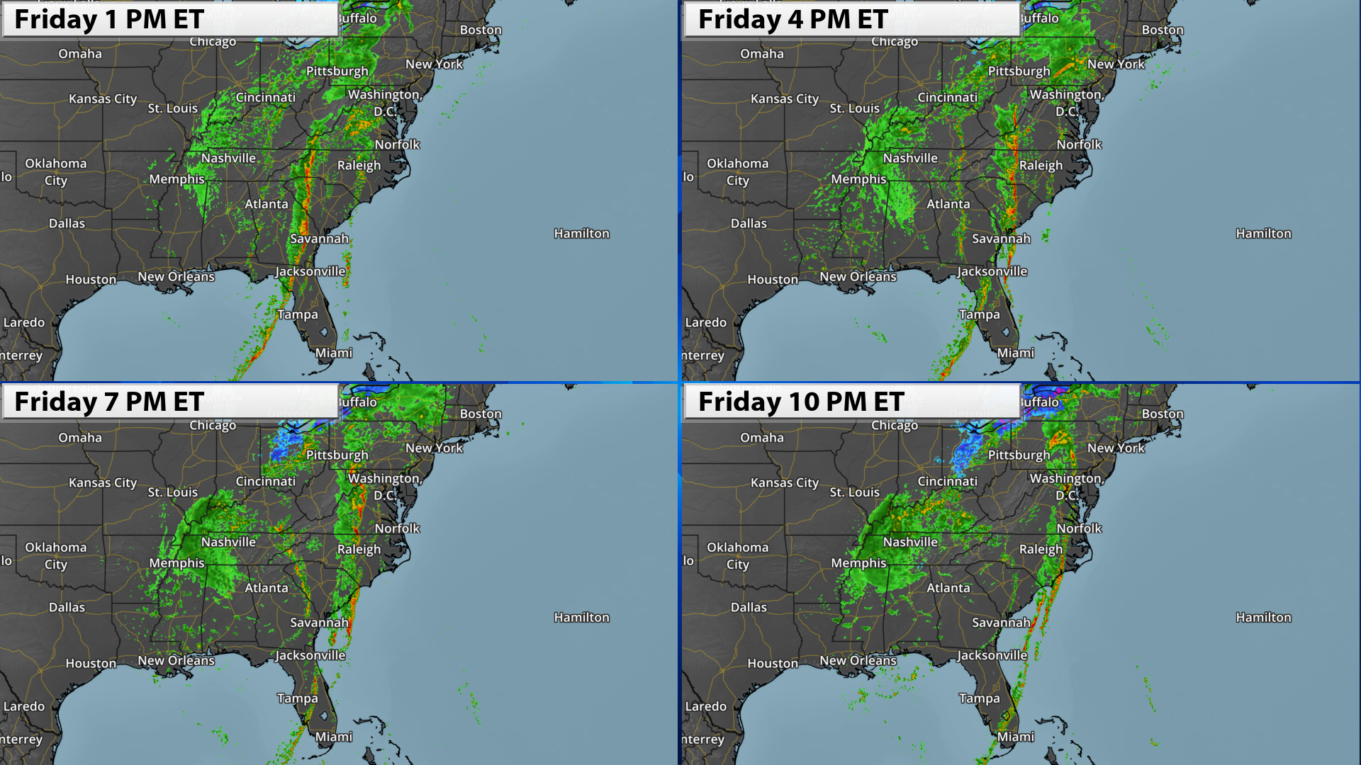
Simulated Radar Forecast

24-Hour Storm Reports

Lightning Strikes & Density
How do our clients use our graphics?
Our graphics are used in many different ways ranging from broadcast television to websites and social media. Our high-resolution weather graphics and weather maps are offered in all shapes and sizes, for any geographical location, at very affordable prices. We have multiple options for base-maps and a full suite of weather data layers to choose from. With the ability to include your own branding and/or sponsor overlays, monetizing weather graphics has never been easier. Want to learn more? We’d love to hear from you!